Helena, MT
Phone: 406-449-5490
- Bird Watching
- Hiking
- Picnicking
- Sightseeing
- Wildlife Viewing
- Trail
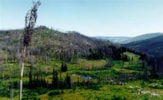
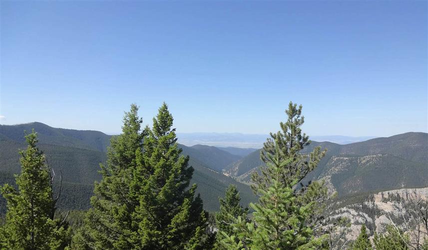
Refrigerator Canyon Trail (259) is a scenic trail leading into the 28,560-acre Gates of the Mountains Wilderness Area. The first quarter-mile is truly spectacular as it enters a narrow canyon with 200-foot high limestone walls. Pines seem to jut at odd angles out from the most unlikely places high up on the walls of the canyon wherever there is a ledge or a crack just big enough to accommodate a tree's roots. The canyon in appropriately named; cool breezes blow over the stream and between the rock walls, creating a "refrigerator" effect. Even on the hottest summer day, the breezes will cool you off, so it's a good idea to take a jacket on this hike.At the quarter-mile point the walls nearly meet as the trail passes a 10-foot wide slit in the canyon that was carved through limestone rock by a small mountain stream. You have to walk through the middle of the small, shallow stream at this point and cross over it at several other points along the trail. For about the first half-mile the trail is rocky, but soon after it becomes a very nice, well-maintained hiking/horseback trail, no longer teeming with large, jutting rocks that an unsuspecting hiker could trip over or slip on. (The only lapses in trail quality occur later on when the trail skirts a steep hill and the trail is covered with small, slippery rock pieces instead of packed dirt and a section that becomes muddy during rainy months.)A little farther up the trail there are a series of gradual switchbacks through a green, shady wooded area. Squirrels and butterflies are easy to spot in this area, and birdsong and buzzing bees are never out of earshot. The trail leads up to some great viewpoints, one of them at wooden railing near the top of the switchbacks. Sheep Mountain and Candle Mountain, each over 7,000 feet, are visible from the high points along the trail. All of the area's large mammals are known to live in this region. Try taking along a pair of binoculars and scan the rocky outcroppings and peaks for mountain goats, deer, and other wildlife from the viewpoints. Refrigerator Canyon Trail (259) meets with Trail 252 after about 3 miles. Trail 252 heads right toward Porcupine Creek, but if you're hiking to the Meriwether Picnic Area you'll want to stay left on Trail 259. Signs are posted at trail junctions. With larger groups, these junctions are a great place to take a quick break, drink some water, munch on a granola bar, or snap some photos. This allows everyone can catch up and regroup before continuing on. After the switchbacks, the trail gradually levels out for several miles.About 5 miles after the junction (8 miles from the trailhead), you reach Bear Prairie. The grassy mountain meadow makes a great place to stop for a picnic lunch and relax. Colorful wildflowers abound, including gorgeous Indian paintbrush. For a mini botanical excursion, pack a wildflower identification guide with the rest of your gear and investigate the varied flora Bear Prairie has to offer. Shortly after Bear Prairie, Refrigerator Canyon Trail ends after 9 miles at Trail Junction 252. If you want to continue on, Trail 252 leads to Kennedy Springs, which is 10 miles from the Refrigerator Canyon trailhead. This trail ends about another two miles later at Trail Junction 253, where Meriwether Canyon Trail (253) begins and continues for the last 6 miles to Meriwether Picnic Area, 18 miles from Refrigerator Canyon's trailhead. PLAN AHEAD! Plan out routes along the trail system and arrange transportation ahead of time. For a long day hike without having to leave a vehicle or arrange to be picked up by car or boat, you can hike up to Bear Prairie and then turn around and hike back down to the trailhead where you parked your car. This is about 16 miles roundtrip, so start early. For horseback riding, backpacking, or a strenuous day hike, however, you may want to plan to hike the 9 miles to the end of the Refrigerator Canyon Trail and the rest of the way to Meriwether Picnic Area for a total of 18 miles. Contact the Helena Forest Service for maps and brochures. Length: 9.0 miles. Moderate difficulty.Trail Begins: Forest Road 138Trail Ends: Trail Junction 252Area Map: Helena Forest Visitor Map USGS Map1: HogbackUSGS Map2: NelsonTownship 13N; Range 1W; Section 28