Cherry Creek Trail

Wise River, MT
Phone: 406-832-3178
Length: 3.4 miles
Difficulty: Moderate
Use: Heavy
Trail Begins: Cherry Creek Road 1011
Trail Ends: Cherry Lake
The trailhead is undeveloped and the last mile of the Cherry Creek road is eroded and passable only by 4-wheel drive vehicles. The trail is open to motorized use and it is a popular area for motorcycle and ATV users.
This trail was actually an old mine road accessing a small mine approximately 2.5 miles from the end of the present day road. The trail follows the Cherry Creek drainage to three lakes. It climbs moderately steep most of its length.
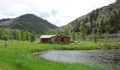
The trail is an old jeep road making it easy to follow. The trail begins in a wooded area on the north side of Cherry Creek where the present day road ends. There are a couple of steel pipe gate posts at the creek crossing. The first mile is low and gentle as it climbs slowly along the base of Storm Peak following the bottom of Cherry Creek. the trail passes through stands of lodgepole pine and douglas fir on the drier slopes with spruce along the creek and whitebark pine near the lake basin. After the first 1.5 miles the trail climbs out of the valley bottom through drier forest and sagebrush covered hillsides as it follows Cherry Creek up its canyon toward the lakes. The hike is somewhat steeper here. About 2.5 miles from the trailhead, the trail passes by an old miner's cabin. Next comes crossing two large meadows where tread was turnpiked and a small puncheon bridge placed across the creek. Many flowers decorate the landscape. On the west side of the meadow the trail forks. The short righthand 0.25 mile long side trail leads to Granite Lake and is fairly steep and offers great views of the surrounding mountains as it ascends an open ridge toward the lake. The trail to Cherry Lake is not as steep and is wet and rocky in places as it passes through stands of wattlebird pine. Both Granite and Cherry lakes sit at the base of Granite Peak. Western shorelines of both lakes are open grass and talus covered slopes with cliffs above. Often mountain goats can be seen grazing.
Area Map: Beaverhead-Deerlodge National Forest Visitors Map
USGS Map1: Vipond Park SE
USGS Map2: Storm Peak
Township 3S; Range 10W; Section 8