


Tobacco Roots
As the Corps of Discovery was moving up the Jefferson River, the mountains Lewis was describing were the Tobacco Roots on the east and the Highlands to the west:
“…The valley though which our rout of this [day] lay and through which the river winds it’s meandering course is a beatifull level plain with but little timber and that on the verge of the river. the land is tolerably fertile, consisting of a black or dark yellow loam, [2] and covered with grass from 9 Inches to 2 feet high. the plain ascends gradually on either side of the river to the bases of two ranges of mountains which ly parrallel to the river and which terminate 〈it’s〉 the width of the vally. the tops of these mountains were yet partially covered with snow while we in the valley were suffocated nearly with the intense heat of the midday sun…” —Meriwether Lewis, August 2, 1805
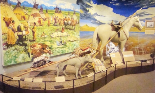
History’s record doesn’t make it clear as to how the Tobacco Root Mountains received their name. Various sources attribute it to the practice by early trappers and miners of mixing species of dried native plants, such as arnica and kinnikinic, with an introduced species called mullien to make tobacco. Other reports say the name derives from the bitterroot, the state flower of Montana. The Shoshone often cooked the root and ate it, and early settlers claimed it smelled like tobacco.
Originally labeled the “South Bowlder Range,” by the Hayden Expedition in 1873, and then “The Jefferson Range,” as seen on early 1900s atlases. The name Tobacco Root appeared in the late 1800s when miners migrated to the area after gold was discovered in nearby Alder Gulch in 1863.
Signs of mining activity, some relics dating back to the 1860s define this southwest Montana massif. Prospector created trails and roads are scattered throughout. And some sites are historically significant Many mining claims were patented, resulting in scattered private in-holdings. Most of the range though is public land and part of the Bearverhead-Deerlodge National Forest.
Nevada City and Virginia City, in Alder Gulch, on the southern end of the Tobacco Roots, have been designated an historic district, with several museums, including the River of Gold Mining Museum chronicle a colorful past.
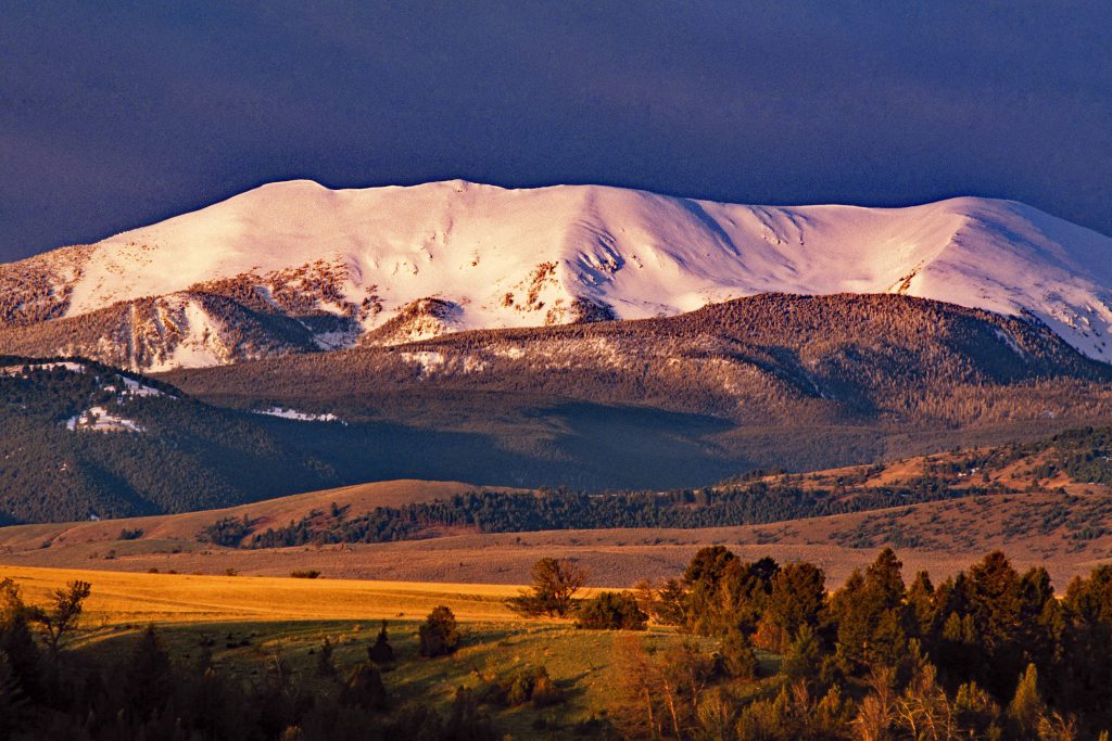
Known by locals as “the Roots,” the range rises between the Jefferson and Madison Rivers, southeast of Whitehall and northwest of Ennis. Ascending from gentle hills of sagebrush, through forests of Douglas fir and lodgepole pine, upwards to high-alpine peaks and lakes, the Tobacco Roots encompass a wide-array of topography and vegetation, sustaining a diverse wildlife population. Elk, whitetail deer, mule deer, black bears, mountain lions and pronghorn inhabitant the range, along with one of the state’s largest population of mountain goats. Grizzly bears and Canadian lynx have also been reported in the range.
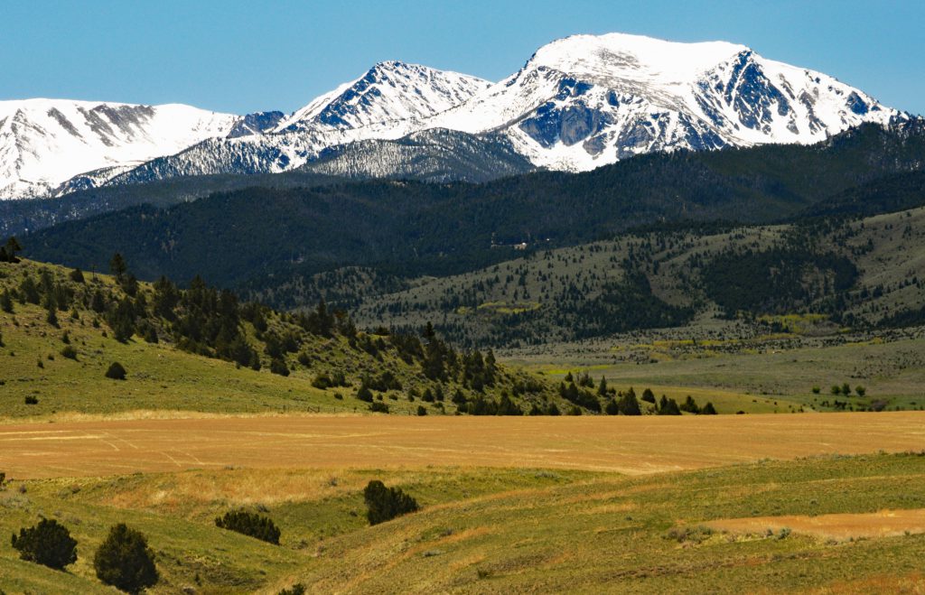
Hollowtop Mountain, 10,604-feet is the highest summit, and 42 other peaks reach beyond 10,000 feet. This lofty country may well hold the densest concentration of high peaks in Montana. Glaciers that disappeared long ago created hanging valleys and cirques, many holding glacial tarns that are frozen well into summer. And each ice carved U-shaped valley boasts of beautiful small meadows. Alpine scenery at its best!
A mass of igneous rock termed the Tobacco Root Batholith makes up the core of the uplift. In terms of age, the formation dates to the Late Cretaceous period from 66 million to 100 million years ago. Granite, an igneous rock, and gneiss a metamorphic, are clearly visible in the high, steep walls that edge the nearby Madison, Ruby and Jefferson Rivers. The northern flank of the range contains sedimentary and volcanic rock.
According to geologists, the gold deposits that attracted so many prospectors most likely derived from the intrusion of the batholith into northwest-trending faults, particularly near the small community of Pony on the east side of the range. Precious metals are found in the contact zone between, in this case, igneous rocks, the batholith, and sedimentary rocks, limestone.
And these faults have provided a duct to allow hot water rising from deep within the earth to flow to the surface as hot springs. The Potosi Springs near Pony are a result of this underground structure. Today, the mountains are used mostly for summer livestock grazing, logging and recreation. Fishing, hunting, hiking, horseback riding, mountain-biking, and snowmobiling are popular pursuits. The high-country holds numerous alpine lakes containing cutthroat trout and are a goal for hikers with fishing rods.
More than two dozen mountain lakes in the Tobacco Roots were initially stocked by Montana Fish & Game when the agency was first created and in the early 1900s miners did their part. Fish were packed in on horseback and released to provide a food source and to create recreational fisheries. Many of the lakes in the range continue to see regular stocking.
The US Forest Service has divided the Tobacco Roots into management zones with differing goals and objectives. The Brown Back Management area is administered for recreation, wintering wildlife, and livestock grazing. Owing to wildlife considerations this area is semi-primitive and limited to non-motorized travel in the winter. Meadow Creek area is for recreation and timber production. Mill Creek Corridor is regulated for dispersed camping opportunities and motorized uses, and the Middle Mountain sector is one of the few places in the Tobacco Roots where recreationists can find, in fall and summer, a quiet non-motorized backcountry experience.
South Boulder and South Willow are signed for concentrated recreation and road access, while the Tobacco Root Peaks Management Area provides opportunities for motorized entry to some mountain lakes and alpine areas—many of which require high-clearance off-road vehicles—while others are accessible only by foot, horse, or mountain bike. There are a few developed campsites in the area, but many campers opt for dispersed camping along the various streams and at trailheads.
There are several access points to the Tobacco Roots on all sides. One of the most popular leads to trailheads in the middle of the range. From I-90, take the exit 256 for Cardwell and head south for a few miles then turn on South Boulder Road to approach the area. Another well-defined route, this one on the east flank is the Louise Lake National Scenic Trail and the Potosi Trail.
All of the geography that is the Tobacco Roots and the surrounding terrain is part of the Greater Yellowstone Ecosystem’s northwest perimeter and as such is an integral part of this natural system’s wildlife connectivity.
A map of the Beaverhead-Deerlodge National Forest will show the way through this wild country and the possibilities. Beartooth Publishing also produced a map covering the range. Search on-line for the forest headquarters in Dillon and you can order the forest map; the same for Beartooth Publishing and a specific map of the Tobacco Roots.


