Lima Montana
Community Overview
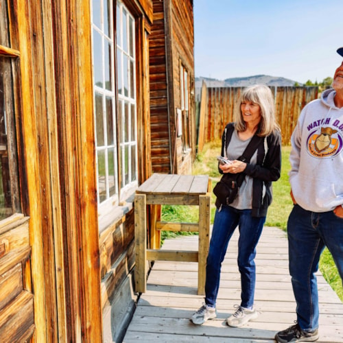
This Montana community of only around 200 people has gone through a number of name changes since its founding as Allerdice in the late 1800s. However, Lima has always maintained a reputation for hospitality and adventure. Located just 50 miles south of Dillon on Interstate 15 and home to a number of outfitters, Lima is the perfect place to start a day, or a week, of packing, hiking, and camping in the nearby Beaverhead-Deerlodge National Forest or birding in the Red Rock Lakes National Wildlife Refuge. In addition, Lima offers ready access to the fly fishing, floating and scenic vistas and of the nearly 70 miles of the Red Rock River. Spend a day fishing and floating on the Lima Reservoir, then enjoy the comfort of Jan's Café and Cabins, voted by Montana Magazine "best homemade pies" around. A number of businesses provide lodging in the Lima area, making it even more convenient to be at the fishing holes during the best times of day, or to snap pictures of the twilight-lit trumpeter swans at the Red Rock Lakes National Wildlife Refuge.
Community Info
Lima Elevation: 6,253'
Lima Population: 212 (2020)
County: Beaverhead
Beaverhead Chamber of Commerce Beaverhead Deer Lodge National Forest Dillon to Philipsburg ItineraryIn the Lima, MT Area:
Get Out and Explore.
Weather Forecast for Clark MT:
62°
OvercastA Small Town with Big Adventures Lima, Montana: A Community Profile

Located in far southwestern Montana, sometimes referred to as “southern gate of the Treasure State, Lima is a vibrant community known for its mountain views, outdoor recreation, and hospitality. With a population of just over 200 residents as of the 2020 census, Lima is a hidden gem for adventurers looking to explore Montana’s unpopulated southwestern border area.
The town is flanked on the southwest by the soaring and impressive Lima Peaks, a series of summits that form part of the Continental Divide and the Montana-Idaho border. Rising to impressive heights, including Garfield Mountain, the highest at 10,961 feet, the range is characterized by steep, windblown slopes, rocky chutes, and lower elevation forests of Douglas fir, mountain mahogany, and lodgepole pine. During winter and spring, snow drapes the ridgelines, creating a wave-like effect.
Originally established as Allerdice in the late 1800s, the town underwent multiple name changes, becoming Spring Hill before finally settling on Lima in 1889. The name was inspired by Lima, Ohio, the hometown of an early settler. High valleys of the area are home to many multigenerational ranches, some dating back to the 1860s. Since its early days, Lima has been a welcoming stop for travelers.
On May 9, 1880, The Utah and Northern Railroad crossed the Montana-Idaho (Montana was still a territory) border in Monida Pass. Fifteen miles later it reached Lima. The town eventually became a railroad off hub and transportation center. It had a 14-bay roundhouse with turntable for steam engine repair.
Lima is excellent base for exploring the nearby high peaks of the Beaverhead-Deerlodge National Forest and wildlands in all directions. Hiking and biking possibilities are many. Activities ranging from backpacking and camping to wildlife viewing in the renowned Red Rock Lakes National Wildlife Refuge, a sanctuary for the Trumpeter swan. Red Rocks is reached from either the Lima Reservoir area or from Lima and Monida off of the Interstate 15 South.
For those who love fishing, the nearly 70 miles of the Red Rock River skirting the northeast side of town provides ample opportunity for both. East of Lima anglers can spend time at the Lima Reservoir, known for its excellent fishing and calm waters.

For hikers and cyclists, the area offers access to the Continental Divide Trail. The Sawmill Trailhead and Shineberger Trailhead serve as key entry points, providing opportunities for resupply and camping. Adventurous hikers can trek, and cyclists ride the Middle Fork Road to reach White Pine Ridge, a remote and rewarding route through Montana’s wild backcountry and other trailheads west of Lima lead into the Lima Peaks and the Tendoy Mountains.
Also in Lima’s southwest view, the Red Conglomerate Peak formations rise along the Continental Divide. A canyon separated them from the Lima Peaks. Camping sites and trails to the high country are reached from Sawmill Road, southeast of Lima. This cluster of unique reddish volcanic and granite rock formations provides a rugged backdrop for hiking and climbing. While three notable features lie just across the Idaho border, the nearby 10,106-foot North Summit, located in the Centennials Mountains, marks the Continental Divide.
Despite its small size, Lima boasts an impressive reputation. In 2022, the town won the award for the best-tasting water in Montana, a testament to the purity of its natural resources.
For those looking for a cozy place to stay, the Beaverhead Inn and RV Park offers year-round accommodations. After a day outdoors, visitors can unwind at the Homestead Café.
More from Our Blog
Dig Deeper