Crescent Lake Trail 92

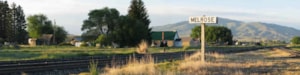
Wise River, MT
Phone: 406-832-3178
Length: 6.3 miles
Use: Moderate
Difficulty: High
Trail Begins: Canyon Creek Guest Ranch Road 7401
Trail Ends: Crescent Lake
The Canyon Creek Trail begins in the low valley of Canyon Creek, the walk is gentle and level on this section and passes through lush forest of spruce, fir, Lodgepole pine and white bark pine. Lush undergrowth of alder, willow, and Labrador tea abound underneath the canopy of trees. At the junction with the Lion Creek Trail 28, the trail drops off the bench and crosses Canyon Creek at a ford then heads southwest from the creek up and across a dry, sagebrush covered hillside. The climb is moderate and the view is scenic as the Roilene across the valley looms against the skyline. Mountain goats can be seen grazing on the ridge or cliffs below. After a half mile the trail heads into lush forests. The walk is moderately steep but not overly difficult. The trail then levels out over the next mile and splits. The left fork is the Canyon Lake Trail 88 and is a fairly steep one mile long trail that drops down 0.5 mile to Canyon Lake. Canyon Lake is a pleasant lake surrounded by timber on its south side and open marshy meadow on the north side. Next is a steep 0.5 mile climb to Lake Abundance. Crescent Lake Trail continues to travel high on a side slope in places following benches for another .5 mile. Crescent Lake sits near the timberline.
For stock users there is a stock ramp and parking area 0.25 mile east of the trailhead. The existing trailhead consists of a small three car parking area at the entrance to the four unit Canyon Creek Campground. No Turnaround for larger vehicles at the small parking area. The trail is closed to motorized use by trail bikes and ATVs. This trail system provides access to six lakes including Grayling, Vera, and Lion lakes via Lion Creek Trail 28 and Canyon, Crescent and Lake Abundance Lakes via Trail 92. All the lakes support trout populations.
Area Map: Beaverhead-Deerlodge National Forest Visitors Map
USGS Map1: Vipond Park SW
USGS Map2: Mount Tahepia
Township 2S; Range 11W; Section 34