Alice Creek
Lewis & Clark History on the Helena National Forest
Note: This article appears as it was sent to us and is edited only to shorten.
On June 30, 1806, the Lewis and Clark Expedition again reached Traveler’s Rest in the Bitterroot Valley near present-day Lolo, Montana. They rested here for three days and struck a plan to part ways and explore two different regions. The plan was that Clark’s part would explore the Yellowstone River and then join forces with Captain Lewis at the mouth of the Yellowstone. Lewis was to go to the Missouri River, then on to the Marias River, and back again to the Great Falls along the Missouri. His purpose in exploring the Marias was to see if it drained to northern reaches, thus giving further territorial claims to the United States under the Louisiana Purchase.
On July 3, 1806, Meriwether Lewis parted ways with William Clark at Travelers’ Rest. He departed with seventeen horses and a party of fourteen men including five Indian guides. The party headed north traversing along the Clark Fork River near Missoula to its confluence with the Blackfoot River. On parting ways with Captain Clark, Lewis admitted, “I could not avoid feeling much concern on this occasion although I hoped this separation was only momentary.” Lewis’s party traveled on a “road” along the Blackfoot River referred to as the “Buffalo Road River” or the “Cokahlarishkit” trail by the Nez Perce Indian guides who accompanied Lewis.
Nez Perce guides told Lewis that the trail was a “well beaten track” and would be easy to follow. The Nez Perce would only travel with Lewis to Hellgate Canyon near present-day Missoula for fear of reprisal from their enemies, the Atsina, Crow, and Blackfeet Indians. The guides told Lewis that these Indians would cut his party off, but Lewis elected to continue. Before the Nez Perce departed, Lewis sent out several hunters “to kill some more meat for these people whom I am unwilling to leave without giving them a good supply of provisions after having been so obliging as to conduct us through those tremendous mountains.” As Lewis’s Indian guides departed, heading back the same way they had come, he comments that their selected return route provides “sufficient evidence that there is not so near or so good a route to the plains of Columbia by land along that river as that which we came.”
The Nez Perce advised Lewis that near the ridge of the Continental Divide the road forked. They recommended that Lewis follow the left fork (up Landers Creek) but said that both would lead to the falls of the Missouri. The right fork of the trail would have led the party over Cadotte’s Pass. There is speculation that the section of trail that went up Lander’s Fork and over Lewis and Clark Pass was used by Indian groups going to and from the Sun River drainage, whereas the Cadotte’s Pass route was used largely by Indian groups going to areas farther south in central Montana or near the headwaters of the Missouri.
As Lewis traveled up the Blackfoot River to Lander’s Fork, he mentioned passing five different abandoned Indian encampments composed of between eleven and thirty-two lodges. He remarked that the lodges were made from brush, bark, and sticks. Lewis also comments on the tracks of a returning war party of the Minnetares and that the party must have had “a large passel of horses” as indicated by their tracks. The party camped at the mouth of Beaver Creek just 2 miles west of present-day Lincoln on July 6, 1806. It was here that Lewis noted the remains of thirty-two abandoned Indian lodges. Lewis also mentioned seeing signs of buffalo in the Beaver Creek area, noting that these signs indicated that bison did penetrate on the west side of the Rocky Mountains.
When the party headed out on July 7, 1806, the day they would cross what was later called Lewis and Clark Pass, it was cloudy and cold, unlike the pleasant weather they had thus far experienced on their solo venture. As they traverse their way up the Alice Creek drainage to the pass, they were fooled into thinking they had reached the headwaters of the Missouri. Though Lewis does not report this incident, Patrick Gass does in his journals. Gass states, “we passed over the ridge and struck a small stream, which we at first though was the head waters of the Missouri, but found it was not.”
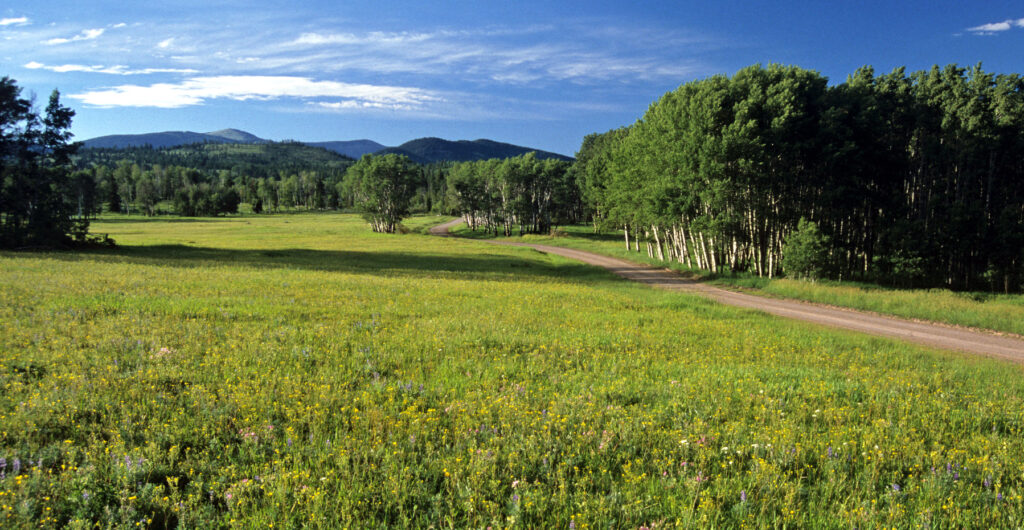
Lewis and his party traveled up Lander’s Fork and Alice Creek, finding that game was plentiful. They shot three deer and a fawn. They also shot a moose but it escaped. Travel though the area produced great anxiety. As Captain Lewis notes in his journals, the party expected “to meet with the Minnetares and are therefore much on our guard both day and night.” As the party headed north along Alice Creek to Lewis and Clark Pass, Lewis made note of the extensive beaver dams along the creek bottom. As the party reached the top of the pass, referred to as the “the gap,” Lewis spotted Square Butte, noting that it “appears to be distant about 20 miles.” In crossing the pass, the group had once again returned to the familiar territory of the United States.
From Lewis and Clark Pass, the party descended the mountain to the east and camped near its base, having on this day traveled a total of 32 miles. At that night’s encampment, one of the hunters, Drewyer, killed two beavers and shot a third that had bit his knee very badly and then escaped.

The following day, the group traveled almost due north to the Medicine River (Sun River) where they Camp on July 8, 1806. Once on the side of the Continental Divide, started seeing buffalo and, after months of relatively poor rations, rejoiced to be back in Buffalo country. On July 13, 1806, Lewis and his nine men reached the Upper Portage Camp above the Great Falls of the Missouri.
On their trip westward, they had cached several items at this camp. When they returned to dig them up, they encountered several grizzly bears in the vicinity. One of the men, Hugh McNeal, broke his musket over the head of a grizzly trying to protect the cached goods.
Captain Lewis was an astute observer and a meticulous note taker. However, when he and Clark parted ways on July 3, 1806, his notes became fragmented and continued in this manner through July 15, 1806. He left blank pages in his notebook for these days, possibly having intended to fill them out in greater detail later, but he never did. Interestingly, the time in which fragmentary notes were taken, Lewis had parted paths with Captain Clark and was also in an area that his own Indian guides would not travel for fear of the Crow and Blackfeet Indians. These factors likely created greater stress for Captain Lewis than is apparent in his journals, and hence may be the reason that his note taking departed from his usual standard. Books about Lewis & Clarks’ journey are available at all offices of the Helena National Forest or call 406-495-3711 for more information.
After Meriwether Lewis passed through this area in 1806, the next documented visit came nearly forty years later when missionaries Father Nicolas Point and Father DeSmet arrived in the Rocky Mountain region to establish missions among the Indian tribes. Father Point held the duty of official diarist and maintained detailed notes regarding the customs, dress, and interactions among Indian tribes. Father Point is credited with establishing the first Christian mission among the Flathead Indians in the Bitterroot Valley in 1841, and he also unsuccessfully attempted to introduce Christian religion to the Blackfeet Indians in 1846.
He converted many Flathead Indians to a Christian form of worship, though the Flathead continued to perform traditional Indian religious ceremonies as well. Point traveled with the Flathead on thirty-plus-day excursions to and from bison hunts east of the Continental Divide. They traveled along the Cokahlarishkit/Lewis and Clark trail observing tribal customs regarding hunting and gathering techniques and commented on the importance of the buffalo to Flathead people for both trade and food.
Father Point provided vivid descriptions concerning the unrest between Indian tribes. In particular, the Crow and Blackfeet taunted the Flathead and continually stole horse from them. Point describes the Flathead as keeping to themselves as much as possible and carrying out both Christian and Indian ceremonies to ensure their safe return from buffalo-hunting ventures. Father Point described the Flathead as a gentle and generous people who practiced ethical judgment. While traveling with the Flathead on a winter buffalo hunt in 1842, Point witnessed that the Fathead extended kindness even toward their enemies, the Blackfeet. In meeting with the Blackfeet during the hunt, the Flathead invited them to smoke a pipe as an offer of friendship. Point, amazed by the encounter, wrote that the Flathead had “thought of only receiving in friendship, those who had raided them so mercilessly. Hands were shaken in sign of reconciliation, a dance was held, the calumet [pipe] was smoked . . . just as if relations had always been friendly.”
On one buffalo-hunting venture with the Flathead, Point writes on September 28, they had reached “the summit of a mountain from which one could see a horizon more than a hundred leagues in circumference, after reciting the first Vespers of St. Michael, I made and planted a cross . . . for we were in the middle of the Blackfoot country.” Here, Point may be referring to Lewis and Clark Pass and the panoramic view from the top. His reference to planting a cross is of great interest because a stone structure in the shape of a Celtic cross lies at the top of the pass. However, his statement that a cross “was planted” may indicate the cross was made of wood, rather than from a series of stones. However, stones are plentiful on top of the pass and wood is scarce, making stones the easiest and most accessibly building material. The reference indicates early missionaries left Christian icons as they traveled through new territory, both as a form of prayer and as a way of introducing their preferred method of worship.
While Fathers DeSmet and Point were with the Indians in the Rocky Mountains, they watched buffalo populations decrease and the demand for the resource intensify. Use of the Cokahlarishkit Trail began to decline by the 1860s when free roaming buffalo herds not longer existed and the nomadic life style of many tribes ended with their forced remove to Indian reservation.
In the 1840s, fur trading between the Indians and European settlers gained importance and fur trading posts were set up throughout the Rocky Mountains. The Flathead trapped animals with simple deadfall traps, capturing mink, otter, wolverine, marmot, muskrat, lynx, and woodchucks. After trading posts were established, beaver became an important trade commodity.
Between 1853 and 1855, the governor Washington Territory, Issac Stevens, send several military parties west to explore and document a potential route for a transcontinental railroad and a military road. The military wanted to improve transportation and communication from the East to the West Coast, and so they sent various expeditions west to collect information on the land and its resources and inhabitants. During these years, many of Steven’s parties traveled along the Blackfoot River via the ancient Indian trail. He men who led expeditions in the Blackfoot River/Alice Creek area included Lieutenants Saxton (1853), Grover *1854), Mullan, Donald, and Governor Stevens (1853 and 1855), James Doty (1854), and FW Lander (1853). The name Lander’s Fork was given by James Doty in 1854 in honor of his compatriot, F.W. Lander. Most of the notes from these expeditions were absorbed into Steven’s final report of 1855.
Governor Stevens favored the proposed railroad route that passed though the Blackfoot Valley. In determining whether the rails should cross over Cadotte’s or Lewis and Clark Pass, Stevens noted that Lewis and Clark Pass would require the construction of an underground tunnel that would extend only 2.5 miles, whereas the Cadotte Pass route would require a tunnel 4.25 miles in length. In reference to the Alice Creek Valley, Stevens stated that it is “the most remarkable valley that I have ever seen in the immediate region of a mountain divide.” Stevens described Lewis and Clark Pass as on that wagons could pass with only gentle “declivities” on either side and further states that little or no timber would need to be cut away to clear a passage. In reference to the Cokahlarishkit Trail along the Blackfoot River and Lewis and Clark Pass, Stevens described it as a “well-worn road” that was perfectly suitable for wagons.
Lieutenant John Mullan later traveled through the Blackfoot country several times in the early 1860s as he compiled information on the construction of a military road from Fort Walla Walla to Fort Benton. In his report, he commented on the proposed railroad route advocated by Governor Stevens that was to cross Lewis and Clark Pass. He wrote, “In the report submitted to Congress by the late ex-governor, I.J. Stevens, a line via the Big Blackfoot and Coeur d’Alene Valleys was favored. But with all due respect for the judgment of this worthy man, and the opinion entertained by him, I am convinced that, had he known that the element of snow existed on these two lines to the great extent that we found it by a three winter’s experience, this judgment would have been reversed, and he would have selected
the line that I here advocate as the best.” Later a decision was made to build the road south of the area supported by Stevens over Mullan Pass about 25 miles south of the Blackfoot drainage. The route selected required about 300 extra miles of railway line but avoided areas of heavy snow and construction of multiple tunnels. In his 1863 report, Mullan provided a detailed map, at a 1:300,000 scale, of transportation systems in the area. The various trails on the map appear to represent segments of the Cokahlarishkit Trail network or corridor.
In July of 1870, General John Gibbon led a military part to the Upper Blackfoot and Dearborn drainages to ascertain the route that Lewis had followed more than sixty years previous. The intent of the expedition was to settle confusion over which pass Captain Lewis had crossed, the one now called Cadotte’s or the one later named Lewis and Clark Pass. Gibbon set out with a “pocket” version of Lewis’s journal and attempted to find the route through a survey of the area. During the July expedition, he could not ascertain which pass Lewis had crossed. As a result, he set out from Helena in October of 1871 to explore the route a second time. This time he found the stream Captain Lewis spoke of that was called “the Cokahlarishkit, or the river of the road to the buffaloes.” On reaching Lewis and Clark Pass, Gibbon noted the sparse grass on top that unfortunately provided little food for their hungry horses. He also states that the pass “was evidently high enough to be a very breezy place, for the stunted pines which grew there were all lying bent to the eastward very close to the ground, forced to grow that way apparently by the strong western winds which sweep over the mountains.”
The Blackfoot corridor and Alice Creek area were mapped between 1877 and 1911 by Government Land Office survey crews. Much of the area was surveyed by two surveyors, Demas McFarland and Lee Williams. Many of the primary roads and trails indicated on the various township maps appear to represent the Cokahlarishkit/Lewis and Clark Trail. Along some segments the trail is referred to as “Indian Trail” in the surveyors’ notes, but on the actual map, it is labeled only as “Trail.” The trail is also labeled “Lewis and Clark Trail” and also “Road to Lincoln.” These various references likely reflect the change in the use of the trail by 1877. The GLO maps of the trail corridor from the Blackfoot River up Lander’s Fork and over to Alice Creek show the same general location for the trail as that depicted in Mullan (1863).
The mining era began near present-day Lincoln in 1865, when gold was discovered by David Culp and Thomas Patterson in what they later named Abe Lincoln Gulch. News of the discovery brought other miners into the area, and a small community formed at the mouth of the gulch. The 10-mile-long gulch was divided into sections that were placer mined with water brought in through ditches that tapped into the adjacent Keep Cool, Liverpool, and Beavers Creeks. In 1871, the town was in its heyday, with approximately 3,000 people living in Lincoln Gulch. Later discoveries in McClellan Gulch, located about 7 miles southeast of Lincoln, brought another influx of people into the area. These discoveries, followed by others up Washington, Jefferson, and Nevada Creeks, had a lasting effect on the development of the Lincoln area and the overall Blackfoot River drainage.
Road networks increased, connecting various mining settlements to large population areas. The Kennedy stage route that crossed over Dalton Mountain Pass connected the Nevada Creek mining camps with Lincoln Gulch. As travel up and down the Blackfoot corridor increased, the Cokahlarishkit Trail became a stage road and the original travois ruts were replaced with wagon ruts. Homesteading, ranching, trapping, and timber harvesting followed on the heels of the mining boom. With the initial placer mining boom in the Blackfoot Valley, stamp mills were built to crush quartzite and extract the remaining gold. The stamp mills were large and required great quantities of wood to construct. Large and small sawmills were built to meet the demand.
As ore deposits from Lincoln Gulch played out, settlers diversified their livelihoods to survive. The first homestead in the area was filed in 1882 by a miner from Lincoln Gulch, Mathew King. Later homestead claims were established up Lander’s Fork by Owen Byrnes in 1895. Though Byrnes started out with a 160-acre homestead in 1895, by 1927 his original parcel of land had grown to a 2,050-acre ranch, which he named the Silver King Ranch. The history of the Silver King Ranch illustrates the change in land use over the years: The ranch began as a mining operation, then its focus changed to harvesting wild hay, then to cattle and horse ranching, and then to timber claims and land trades. Even later, in 1930, Len Lambkin rented the ranch and began a backcountry outfitting business, reflecting another economic shift, this time to recreation. The Lambkins operated an early hotel in the Blackfoot Valley, recognizing the area’s potential for recreation and tourism.
Other homesteaders in the Lander’s Fork area were Gene Milliron and Harry Harrison who settled there in 1920, each with a claim of 320 acres. Their areas were used for both cattle and sheep herding and was likely sold to either the Blackfoot Cattle Company or the Sieben Livestock Company in 1921. One of the earliest homesteads in the Alice Creek area was the Patterson homestead established by John Patterson in 1898. In the early 1900s, the Patterson’s raised hay on their land to feed the eighty cows they ran in the area. This homestead later become known as the Fickler Ranch and was located along the Cokahlarishkit Trail. The trail actually ran through the ranch yard and the barn straddled it. The Patterson family often saw Indian people traveling along the trail. Unfortunately, the current property owners denied a request in 1999 by the Helena Forest Supervisor to conduct a trail inventory on their property.
John Patterson’s parents moved to the Lincoln area from Glasgow, Scotland, in the 1870s. John Married Stella Miller from Missouri, and they raised their daughters Alberta and Inez in the Alice Creek drainage. Because the Blackfoot Valley was so sparsely populated, there was no school. So, instead the Patterson hired teachers to come from Butte in the summer to teach their children. The winters were so sever up Alice Creek that travel was not possible. The Patterson sold their Alice Creek homestead and moved to the Dearborn drainage 14 miles to the north in 1907. John Patterson later bough an adjoining 160-acre tract that was 1.5 miles closer to the school his daughters attended. The Patterson’s had their Alice Creek Ranch returned to them because the purchaser, Mr. Vianne, failed to make payments. During the winter, Mr. Vianne was unaware how cold it became, and lacking sufficient fuel, he burned parts of the ranch house (furniture, banister, railings) to keep warm. When the Patterson repurchased the ranch in 1932-33 and moved back in, a new kitchen had to be constructed due to the damage done by Mr. Vianne.
Alberta Patterson homesteaded on the Dearborn River in the 1920s, filing on a claim that joined land her father owned in the area. She later filed a homestead claim along “the old Cadotte Indian trail.” Today, Highway 200 follows this trail and runs through Alberta Patterson’s original homestead. While picking serviceberries along the trail, Alberta saw a band of Indians with horses, some with attached travois, pass along the trail.
Inez Patterson homesteaded on Alice Creek north of her father’s property. To the north of her property was the Forest Service Guard Station. Inez married Ed Fickler, and after her father’s death in 1935, she and her husband moved into the main ranch house. Though no longer used and somewhat dilapidated, the original buildings built by both John Patterson and Ed Fickler are still standing and visible from the Alice Creek Road. Rudy Eggenthaler homesteaded Tom’s Gulch, which runs parallel to Alice Creek and is west approximately one mile, in 1923. At the time his property bordered Forest Service land and property owned by Ed and Inez Fickler.
In the 1930s Ron Brown and Ed Fickler began construction of a small hydroelectric station on the upper end of Alice Creek canyon near the Ficklers’ lower meadow. The dam consisted of a medium-sized long-and-earth dam, sluices, and turbines. It was projected that the station would provide power to Glen’s Gulch, Tom’s Gulch, and areas throughout the Alice Creek drainage. The dam was partially built but never completed, and ultimately it washed out.
The Forest Service built the Alice Creek Guard Station near the top of the Alice Creek drainage in 1920. Now only the foundation of this building remains. A fire lookout was established on Green Mountain nearby and was used by guards to watch for fires. An old trail on the ridge north of Telephone Gulch was used to access the Lookout. The Alice Creek Guard Station was sold in 1970 and moved to the Falls Creek area to be used as a hunting lodge by Norman McDonough. The Forest Service Lincoln District office was built in 1935 and continues to provide recreation information and employment opportunities for the town of Lincoln.
Lincoln, Montana is the best base to explore this historic and beautiful landscape of the Upper Blackfoot River. For information and maps call the USFS Lincoln Ranger District (406)362 – 7000


