The Crown of the Continent in Southwest Montana

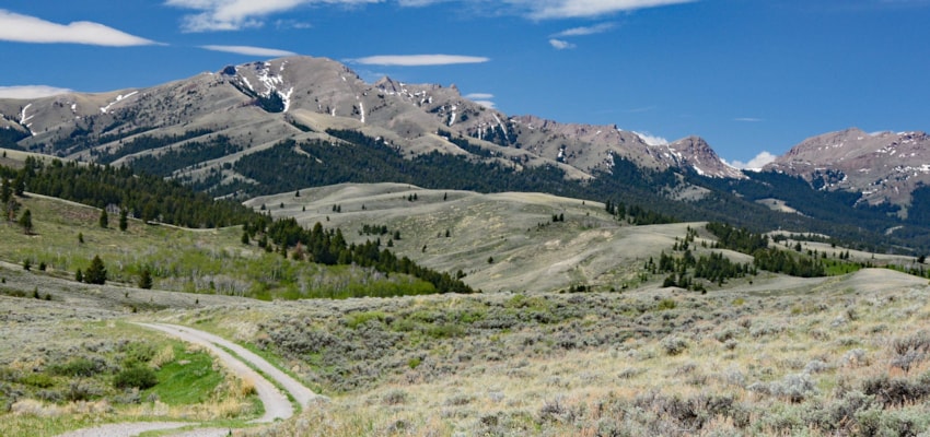
Rising in northwest Montana, southern Alberta and British Columbia, a swath of elevated geography is cast on a colossal scale—immense, vast and dramatic. Here nature mustered many of her greatest powers to create a glorious 13.5 million-acre masterpiece. Mountain building not only thrust rocks skyward, but also pushed them eastward over the sedimentary strata underlying the prairie grass. Eventually, massive forces of ice created valley and alpine glaciers, which when set in motion shaped an uncommon landscape that stands with the best mountain majesty on earth.

Magnificence indeed! Glacier carved peaks—some of their north faces still embedded with remnant glaciers, vast forests rising to the upper reaches of the high-altitude world, wandering river valleys, steep canyons, gushing creeks and water-falls, flowered meadows, and a wild population that represents nearly all the major and minor critters of the Rockies form what many researchers consider to be the largest intact and most pristine ecosystem in North America.
Details of how life came to this storied landscape that would one day come to be known as the Crown of the Continent reach back into antiquity, much of its record lost in the mists of surmise.
Southwest Montana claims about 180 miles of the ribbon of the Continental Divide that defines the Crown of the Continent. Montana’s segment of the Divide in the Crown is approximately 280 miles from where it enters the USA in northern Glacier National Park to McDonald Pass, the southern end point of this ecosystem.
That stretch begins deep in the Bob Marshall Wilderness on Pentagon Mountain and the northern reaches of Lewis & Clark County, terminating on McDonald Pass west of Helena.
Big swaths of geography extend east and west from this watershed partion, with almost all of it in the 2.6 million acres known as Bob Marshall Country. The “Bob” as it often called consists of the three designated Wilderness areas—Bob Marshall, Great Bear and Scapegoat totaling about 1.5 million acres and 1.1 million acres of surrounding defacto wilderness—managed as wilderness but not designated as such.
For the most part landscapes east of the Divide, especially in the northern sector are in Southwest Montana and further south, at the southern end of the Chinese Wall, the topography also includes terrain west of the Divide. County lines as shown on Montana highway maps make it clear where that western extent ends; Lewis & Clark and Powell counties are in the Southewest domain and Missoula County isn’t.
The Rocky Mountain Front, from the Sun River south and west of Augusta is part of this tourism region. Another 475,000 acres of ground south of Lincoln and the Blackfoot River, on both sides of the Continental Divide are also included in Southwest Montana’s share of the Crown of the Continent.
Access to these wild public lands is from Augusta, Rogers Pass, Lincoln, Flesher Pass, Stemple Pass, McDonald Pass, Ovando and Avon. Lincoln, Montana is surrounded by this fabled natural system, the only community that can claim that distinction.


