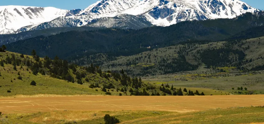
The Gates of the Mountains
A Mystery Unanswered!
Is the place we call the Gates of the Mountains the same one Meriwether Lewis noted in his journal?
On Friday, July 19, 1805, the men of the Lewis and Clark Expedition laboriously worked their boats through a narrow gorge as they pushed upstream towards the head of the Missouri River. They had been passing through rugged canyons for several days, but this was the narrowest and deepest they had found, and the current was viciously swift. The entry in the expedition journal for that day conveys a sense of awe:
… the rocks approach the river on both sides forming a most sublime and extraordinary spectacle. For five and three quarter miles these rocks rise perpendicularly from the water’s edge to the height of nearly twelve hundred feet. They are composed of a black granite near its base but from the lighter color above and from the fragments we suppose the upper part to be flint of a yellowish brown and cream colour. Nothing can be imagined more tremendous than the frowning darkness of these rocks which project over the river and threaten us with destruction… there is not a spot except one of a few yards in which a man could stand between the water and the towering perpendicular of the mountain… This extraordinary range of rocks we called the Gates of the Rocky Mountains…
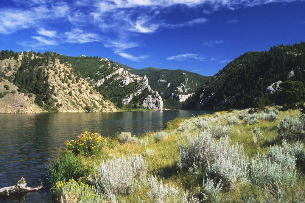
Many years later, historians patiently worked back through the journals of the Lewis and Clark Expedition trying to identify in the now-settled land all the places described by those first travelers in the wilderness. They located Lewis and Clark’s Gates of the Mountains in a narrow canyon about 20 miles north of Helena, which has since become a popular picnic spot. The cliffs there loom over the water just as they did in 1805, but now they overlook the still waters of Holter Reservoir and the sound of a rushing current no longer echoes between them. If it were not for that, the marina on the up stream shore, the motorboats on the water, and the interstate highway on the skyline to the west, Lewis and Clark might still recognize the place if they were to see it again today.
No doubt the historians have been most painstaking in their methodical reconstruction of the route of the Lewis and Clark Expedition. Indeed, the journal descriptions almost always ring true when read in the presence of the landmark the historians have identified. Nevertheless, people who look closely at rocks can’t help wondering whether the name Gates of the Mountains may not have been given to the wrong canyon. None of the rocks in the canyon we now call Gates of the Mountains is granite, or anything even remotely resembling granite and neither is any of them black and there is no such thing as black granite. Nor, for that matter, are there any flints of a “yellowish brown or cream colour.” Instead, all the cliffs in the canyon we call Gates of the Mountains are in white limestone belonging to the Madison Group. They do contain a few nodules of dark brown or black flint, more properly known as chert, but those aren’t abundant enough to lend any color to the scene and most visitors to the park don’t notice them. We can easily forgive Lewis and Clark for not knowing what granite looks like because very few people knew that in 1805. But it is hard to imagine how they could have described the gleaming white limestone as black most of their descriptions were rather good.
The Missouri River does pass through a fairly impressive canyon in black volcanic rocks between Wolf Creek and Cascade, just a few miles downstream from the “Gates.” People who drive the interstate highway between Helena and Great Falls know it well. Those rocks aren’t granite either, but at least they are black. It is tempting to suppose that maybe that canyon is actually the one described in their journal, except that one isn’t either narrow or deep enough to fit their vividly explicit description. So maybe the historians are correct after all. If so, we are left to wonder how the great explorers could have been so absolutely wrong in their color perception.
It is always amazing to follow a river through a broad valley in open country. Many of our Montana rivers do that. Lewis and Clark wondered at that, just as people do today, and speculated that the river seems to have its channel down this solid mass… convulsion of the passage must have been terrible since at its outlet there are vast columns of rock torn from the mountain which are strewed on both sides of the river, the trophies as it were of the victory. They weren’t as explicit as we might have wished in describing how they thought the canyon formed, but they seem to have imagined the water suddenly bursting through in some sort of violent catastrophe. That was a fairly widespread point of view in their time.
Now we understand that rivers don’t open canyons in a sudden magnificent rush of water and rock but instead erode them slowly as millions of spring floods scour their burdens of sand in gravel over the bedrock, grounding grinding a bit more of it away every year. Rivers work slowly but they persist and eventually they saw their way through even the hardest rocks. Some rock formations can slow their passage, but none can stop them as long as the current carries it’s abrasive load of sand and gravel across the bedrock.