Big Belt Mountains
The Home Range for Helena and Townsend

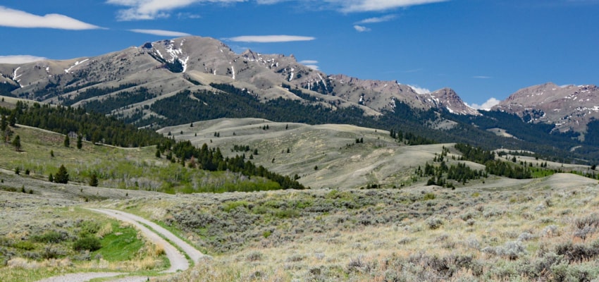
Looking out from the rise of the town of Helena, across the Prickly Pear Valley, the northeast and eastern horizon is dominated by most of the 80-mile length of the Big Belt Mountains. Survey this skyline from the top of Mount Helena and you’ll see the entire massif.
Helena, East Helena and Townsend folks claim this uplift as their own and easily recognize its many distinct high points. Whether peacefully resting on his lofty bed of green, shaking the valley with his thunderous snores or cuddled under a coverlet of snow, the beloved Sleeping Giant, or 6,792’ Beartooth Mountain as the maps label it, rules the northern horizon. Across the Missouri River Canyon from this sentinel, two of the most prominent peaks in the Gates of the Mountains Wilderness, 7,443’ Candle Mountain and 7,980’ Moors Mountain are clearly visible. Then comes the unmistakable long Hogback Ridge at 7,813’. Looking a bit farther south, 8,942’ Boulder Baldy and 8,810’ Boulder Mountain jut up above the surrounding forest. To the east near Townsend, the regal beauty of the two monarchs of the range, 9,467’ Mount Baldy and 9,480’ Mount Edith is reflected in the mirror of Canyon Ferry Lake.
Folks in White Sulphur Springs and the Smith River Valley who contemplate these mountains from their gentler sunrise side, declare some ownership as well.
Lewis and Clark duly noted the stretch of the Missouri River slicing through the Big Belts. Clark came first, camping on the night of July 18, 1805 a bit west of today’s Ming Bar. The next day he continued up the Missouri and out into what is now the Helena or Prickly Pear Valley, just to the east of the interstate. On July 19, he stopped for the evening near present day Lakeside.
Lewis and his contingent, following behind, spent the night of the 18th, a short distance downriver from today’s upper Holter Lake. On July 19, 1805 he noted in his journals
”…. this evening we entered the most remarkable clifts that we have yet seen. these clifts rise from the waters edge on either side perpendicularly to the hight of 1200 feet. every object here wears a dark and gloomy aspect. the tow[er]ing and projecting rocks in many places seem ready to tumble on us. the river appears to have forced it’s way through this immence body of solid rock for the distance of 5 3/4 Miles and where it makes it’s exit below has th[r]own on either side vast collumns of rocks mountains high. the river appears to have woarn a passage just the width of it’s channel or 150 yds. it is deep from side to side nor is there in the 1st 3 Miles of this distance a spot except one of a few yards in extent on which a man could rest the soal of his foot. it was late in the evening before I entered this place and was obliged to continue my rout untill sometime after dark before I found a place sufficiently large to encamp my small party…from the singular appearance of this place I called it the gates of the rocky mountains.”
Somewhat flooded today by the backed up waters of Holter Lake, these Gates of the Mountains are just as magnificent as when the Corps of Discovery first beheld them.
Western Montana was founded on placer gold and the Big Belts lent a hand. While the better-known Last Chance Gulch gave birth to Helena, in 1864, three former Confederate soldiers discovered gold in a steep narrow canyon heading east of today’s Canyon Ferry Lake and christened the area Confederate Gulch.
Diamond City, its “capital,” was supposedly so named, because the initial four cabins formed a diamond pattern in the snow-covered landscape. Sprouting almost overnight, by 1867 an estimated 10,000 people were living in the town and throughout the gulch. In 1870 though, the good times and the gold played out; virtually nothing remains today.
Natural features and recreation opportunities abound in the Big Belts. Dry and not as lofty as other Montana ranges, they do provide an excellent system of trails and great wildlife habitat. And since the snow leaves these mountains early, it’s a popular destination for spring hiking.
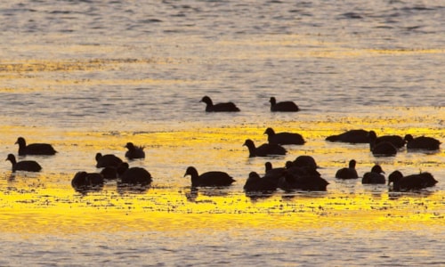
On and below the northern slopes of the Belts, the 32,318-acre Beartooth Game Range offers a haven for almost every big game animal found in Montana. Osprey frequent its river border, a sizable elk herd roams freely and in 1805, Lewis and Clark’s journals noted the abundance of bighorn sheep in the area. The reserve rolls out in what seems like gentle country, but the eastern boundary along Shellrock Ridge rises in an impressive bit of relief, almost 4,288 feet above its lowest point. Managed by the Montana Department of Fish Wildlife and Parks, the range is accessed from Holter Lake.

This wildlife sanctuary is contiguous to the very rugged 28,562-acre Gates of the Mountains Wilderness. Picturesque limestone escarpments that plunge precipitously and steep forested mountainsides are hallmarks of Montana’s smallest wilderness area. Fifty-three miles of maintained trails amble throughout. Candle Mountain, an easy climb from the favorite backpacking destination of Bear Prairie, provides amazing views of the far-reaching landscape.
From its southwest corner, a 16-mile footpath leads through Refrigerator Canyon and across to Meriwether Landing on the Missouri River. A day-trip for some hearty souls, others usually overnight in Bear Prairie. Throughout the warm months, a tour boat stops at the landing and will ferry campers to Upper Holter Lake for a fee. Hikers and horseback riders should be aware that water and horse feed in the Gates of the Mountains Wilderness is scarce.
The road to the Duck Creek Pass area, northeast of Townsend and above the east side of Canyon Ferry Lake, opens up a beautiful and different part of the range. From the pass, one trail heads north to the ridgeline between the summits of Boulder Mountain and Boulder Baldy, two miles apart. A path drops sharply from the ridge to the two Boulder lakes on the north side. This easy to reach place is part of the 30,000-acre Camas Creek Roadless Area.
Walking south from Duck Creek Pass, it’s possible to follow a high divide leading to the summit of Mt. Baldy and then four miles further to Mt. Edith where mountain goats frequent the tundra-like terrain. Other trails descend into Birch Creek Basin, the glacial cirque below the north face of the two peaks. A dozen lakes, reached via horseback and hiking paths, are scattered throughout this roadless enclave. Granite spires, called The Needles, tower above one of the lakes.
For those with a desire for motorized recreation, the Big Belts offer ample routes. Roads in two different directions from York, one via Trout Creek to Vigilante Campground and the other to Beaver Creek and the southern fringe of the Gates of the Mountains Wilderness, as well as Hogback Ridge, show the most spectacular scenery. The towering limestone walls and pinnacles are awesome. Numerous hiking trails emanate from the roads.
Smooth and deep, the Missouri river flows from Upper Holter to Holter Lake on the north perimeter of the range and opens watercraft access to the Belts. A tour boat operates through the Gates of the Mountains from the marina on Upper Holter.
Major fires have also visited the Big Belt Mountains, including one of the most infamous infernos in Montana’s history, the Mann Gulch Fire. Adjacent to the big wall Lewis dubbed “gates of the rocky mountains” and a short way downstream from Meriwether Campground, Mann Gulch ascends steeply from the Missouri River’s east side. It was here on August 5, 1949, that a lightning ignited wildfire over-ran a crew of 16 smokejumpers, trapping them in the narrow gulch. Only three survived. Norman Maclean’s book “Young Men and Fire” details the sad tragedy.
On November 13, 1990, during an unusual dry period for that time of the year, a discarded cigarette caused almost 80% of the Beartooth Game Range to burn. And in the summer of 2000, more than 29,000 acres in Cave Gulch and the Magpie Creek Road east of Canyon Ferry Lake went up in flames. At almost the same time, a large fire burning in the southern fringes of the range, in the vicinity of Deep Creek Canyon, scorched 10,000-plus acres of Forest Service managed lands and on both sides of the road over Deep Creek Pass from Townsend to White Sulphur Springs.
The Big Belts and its wildlands’ roads and trails are popular for all forms of recreation, especially in the Helena and Townsend areas. As a result, conflicts and problems arise. For the most part though, motorized use of the area seems to be compatible enough with those enjoying hiking, cross country skiing, horseback riding and other quiet activities. And with plenty of routes to use in these hills, there is no need to go off road with vehicles. Local public interest groups have documented the scarred landscapes and disturbed animal habitat. The Forest Service law enforcement division is understaffed, making it difficult for them to act. Therefore, all users of the Belts need to become involved. Send your comments to the Townsend Ranger District, 415 South Front Street, Townsend, MT 59644. Their phone number is (406) 266-3425.
The Helena National Forest map has complete coverage of the Big Belts. It also lists the USGS topo maps needed for specific locations. Motorized vehicle use maps are also available on the Helena National Forest website (https://www.fs.usda.gov/Internet/FSE_DOCUMENTS/fseprd516879.pdf).
The precipitous forested slopes, high bare ridges, lake basins, nearly vertical jagged limestone escarpments and narrow steep gulches in the canyons of the Big Belts, are a treasure. Their easy access is inviting. Enjoy them and protect them.


