


Flint Creek Range
Sentinel to the Deer Lodge Valley
From the air this gathering of uplifts looks like an overinflated football.
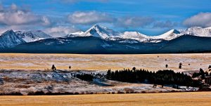
Very visible from Deer Lodge, Mount Powell at 10,168 ft. in elevation soars 5,600 ft. above the southwest Montana town. This impressive rise serves as a western sentinel for the community and is the loftiest summit in the Flint Creek Range, a small but impressive gathering of mountains.
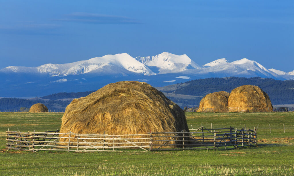
From the east its often-snow-covered pinnacles and ridges can be seen from a distance and stand out as a scenic background for the historic Deer Lodge Valley. Its northern sharp peaks are also visible from Drummond, Gold Creek and Garrison Jct.

Impressive geological features, include a striking ridgeline extending northward to Deer Lodge Mountain. Often described as resembling the backbone of a dinosaur, this ridge is a defining visual landmark when viewed from Interstate 90.
While their sunrise side and rocky peaks brush thin air, the western face is less prominent and is mostly cloaked in a dense forest cover.
By road, the entire range can be circled. And while Deer Lodge claims the most prominent side, Drummond and Gold Creek approach them from the north, Phillipsburg from the west and Anaconda from the south.
Standing apart from the surrounding valleys this relatively small but high-elevation range, is a significant geographical feature in western Montana. While some consider it a northern extension of the Pintler Range, the two are separated by a narrow valley traversed by Montana Highway 1. To the west of the uplift lies the namesake Flint Creek Valley, with the John Long Mountains forming the next notable landform in the region.
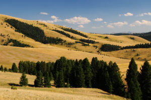
Several important rivers headwater in them. To the west, Flint Creek and Trout Creek carve their way through valleys, while to the north and east, the Clark Fork of the Columbia River makes its way taking water from the range’s east face. Several alpine lakes, including Boulder Lake, Dolus Lake, and Echo Lake, dot the range, offering remote and scenic fishing destinations. On the south, the elevated landscape gives way to the depression that holds Georgetown Lake.
A rugged landscape, it is home to a variety of Rocky Mountain fauna, including a small population of mountain goats. The range is also a favored hunting ground for deer, elk, and blue grouse, though it remains relatively untouched by large-scale recreational use. Fishing opportunities abound in nearby Georgetown Lake, which provides accessible shoreside fishing.
For alpine skiers, Montana favorite and locally owned Discovery Ski Area – formerly Discovery Basin, stands out in the southwest segment of the Flint Creek Range.
Lost Creek State Park, in the southeast edge, and north of Anaconda, features limestone cliffs and multi-colored rock formations rising 1,200 feet above its canyon floor. A short hiking trail leads to Lost Creek Falls, and its impressive 50 drop. Mountain goats and sheep frequent the area.
Though mining activity has declined, the legacy of mineral exploration remains deeply embedded in the Flint Creek Range’s history. Known for its rich mineral deposits, it at one time held significant reserves of tungsten and molybdenum, along with phosphate-rock formations and scattered silver- and gold-bearing veins. On the east side it was historically known for its silver mining, with the area producing $20 million in silver between 1885 and 1893.
Philipsburg, located in the Flint Creek Valley, became a major hub for the mining and trade, with the Hope Mill, Montana’s first silver mill, playing a crucial role in the region’s economy. The most renowned and profitable mining operation was located southeast of the town now home to Granite Ghost Town State Park.
Today mining operations are restricted to manganese oxide and phosphate rock, and the area is also known for its sapphires. Transatlantic Mining has assessed the Golden Jubilee Gold Property, located in the southern part of the Flint Creek Range, which had sporadic gold production between 2000 and 2014.
Despite its historical significance, large portions of the range remain remote, with nearly 60,000 acres lacking road or trail access. This inaccessibility has preserved much of the rugged character of the Flint Creek Range, making it a haven for those with a sense of adventure and a willingness to explore off the beaten path. A few notable routes attract adventurers. The Trail Creek/Trask Creek Trail offers a 15.8-mile out-and-back journey to Trask Lakes, a pristine location popular for fly fishing and exceptional vistas of Mount Powell and Racetrack Peak.
Deer Lodge is the base camp to access trails and routes to the peaks. Born from the cattle business the town offers plenty of amenities for lodging and food.
Although the Flint Creek Range may not be Montana’s most well-known mountain range, it holds a unique place in the state’s landscape. With its towering peaks, rich mining history, and relatively untouched wilderness, it offers a glimpse into the rugged beauty of western Montana. Whether standing as a snow-capped sentinel over Deer Lodge Valley or serving as a remote retreat for wildlife and adventurers alike, the range remains a testament to Montana’s wild and storied past.


