


The Helena-Lewis and Clark National Forest

Perhaps the greatest diversity of any national forest in Montana is found within the Helena-Lewis and Clark National Forest. Spanning almost 2.9 million acres from the Big Snowy Mountains of Central Montana to the alpine peaks of the Continental Divide, it is comprised of island mountain ranges and segments of the Northern Rockies. It is managed by way of six ranger districts, spanning 17 Montana counties. From deep-rooted history to seemingly unlimited outdoor recreation opportunities, the landscapes within the forest have much to offer.
Two previously independent national forests make up the current forest. The Helena portion was established in 1908 and initially covered the landscape around the state capital of Helena. The Lewis and Clark National Forest spans land to the north and east of Helena including the Rocky Mountain Front. It was established in 1906 and was named after the leaders of the Corps of Discovery who passed through the area in 1805 and 1806. In 2015 the forests were combined.
Throughout the early 1900s, several smaller portions of other national forests were added to the Lewis and Clark and account for many of the eastern segments.
Early on significant mining and logging dominated activity but has since slowed. Now, recreation is the most common use, with hundreds of miles of trails, dozens of campgrounds, and places to explore.
History:
Native peoples
Long before the land was a national forest, indigenous peoples made their home in the region and migrated through it. Archaeological data suggest the first inhabitants arrived around 13,000 years ago. These groups, the Paleoindians, were bands of hunter-gatherers, who traversed the prairies and mountains in search of food. Early inhabitants of the area used animal hide-covered tepees, wood lodges known as wickiups, and caves as shelters. Several sites are known, and numerous others existed on the landscape, but many have been lost through years of weathering, mining, logging, and grazing activity.
Early people hunted big game animals and foraged for many different plants. Some of the most common plants in the valleys were bitterroot, biscuitroot, and prickly pear cactus. They also collected and dried plants, grinding them into a flour-like powder that were used to prepare food. Modern tribes still practice some of these early traditions.
Lifestyles of the early people in the area changed drastically with the arrival of two revolutionary items in the early 1700s: horses and guns. Traveling on horseback allowed people to move much further in a day than they could on foot. This allowed the aggressive following and hunting of the great herds of bison which became the primary food source for many tribes. The Blackfeet soon became the most powerful of the tribes in the region, pushing several others such as the Salish and Shoshone to smaller territories further west or south. These tribes and others banded together for journeys to the prairie to hunt bison, as their combined strength gave them stronger protection against the Blackfeet. One of these famed routes was the “great Salish road to the buffalo,” or as it is sometimes called, “The River of the Road to the Buffalo,” which followed the Blackfoot River from western valleys up through the present-day town of Lincoln. The passage then followed Lander’s Fork and crossed the Continental Divide through Cadotte, Lewis and Clark, and other passes.
Today, many different locations in the forest illustrate the history of the early peoples of Montana. Historic dwelling sites, such as tipi rings, remains of wooden lodges (wickiups), rock shelters, and cave habitations can be found across it. In addition, game drives and jumps used for hunting, as well as tool stone quarries are present. Some of the most readily seen and intact artifacts are the paintings and etchings found on cliffs and caves of the region. Many of the pictographs and petroglyphs around Helena are both subtle and complex, with extensive paintings and a range of techniques used. Animals are often depicted in these scenes, as well as human-like figures.
All of these places represent the early ways of life of the people who first called this land home.
Mining
While Europeans had passed through the region before, it wasn’t until the 1860s that they began to settle in the area with the passage of the Homestead Act of 1862. The discovery of gold and other precious metals started a flood of people looking to strike it rich. It started with simple pick, shovel, and pan technology, but soon gave way to more aggressive mining methods to further extract the metals. Mining towns sprang up and disappeared across the landscape, many only surviving for a few years until easy-to-find metals were depleted. After much of the richer regions played out in the 1870s, larger deposits of metals began to be explored. Hardrock lode mining (underground tunneling) began to be the most common mining method across the forest as deeper deposits of ore were sought. The ores were then transported to smelters to be processed, and the precious metals extracted.
World War II was the last boom of the industry in the region, with a drastic increase in the number of materials needed for the war. Once over though, demand dwindled, and many mines shut down operations. By the mid-1950s much of the mining in the West transitioned to large-scale open-pit mining, which was safer and more cost-efficient. This spelled the end of many of the smaller mines within the forest with many falling dormant or abandoned
Elliston, located about 30 miles west of Helena, is one of the former mining districts located within the forest. Mines within this district took advantage of the rich mineral deposits associated with the Boulder Batholith and overlapping Elkhorn Volcanics. Mining primarily focused on the production of lead and zinc, but gold, silver, and copper were also produced in the district. Many of the operations were lode mines, but some placer actvity also occurred.
Elliston was founded to provided food and supplies to area miners. Ore was shipped to the East Helena or Anaconda smelters to be processed and refined. Although the district was productive, the evolution of mining methods to favor open-pit mining in the 1950s spelled the end for most small-scale operations. Activity within the district today is largely limited to prospecting and focused exploration work.
One of the smaller mines that is still standing is the Charter Oak Mine and Mill, a popular site to visit since it has nearly all of its original structures still standing. The lead-zinc lode mine is in the upper Little Blackfoot River Watershed, approximately 25 miles southwest of Helena. Operations at the site started in the early 1900s, producing primarily lead and zinc, although minor amounts of copper, gold, and silver were generated. It experienced several transfers of ownership over the years and by association was faced with periods of little or no ore production or mill output. Activity peaked with the demand for metals during World War II, after the war production slowed and the mine and mill fell into disrepair.
In the early 1990s, a fish kill occurred in the Little Blackfoot River, with the event generally extending from the Elliston area to near Garrison Junction. Upon investigation, it was determined that the fish were likely killed by material flushed from tailings piles located in the floodplain adjacent the Charter Oak Mill. In response, the Forest Service worked with partners to initiate a two-phased reclamation effort (1996 and 1998) to address mill tailings located aside the river and heavy-metals laden waste rock perched on unstable slopes across the mine site. Today, the mine site, structures, and equipment are still there and serve as an interpretive opportunity on the forest. The place is one of the few “intact” World War II-era lode mine and mill sites still in existence on public land in the Northern Rocky Mountain region; it was listed on the National Register of Historic Places in 2001.
Landscapes of the Forest
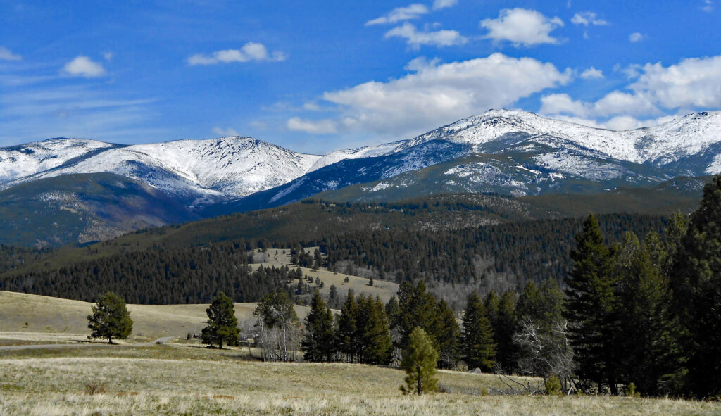
Spanning some 150 miles from Glacier National Park to central Montana, the landscapes found within the forest are incredibly diverse. Much of the eastern realms are island mountain ranges, surrounded by river valleys and rolling hills. The western and central regions are on the slopes of the Continental Divide and boast large rocky cliffs that reflect millenniums of geological processes.
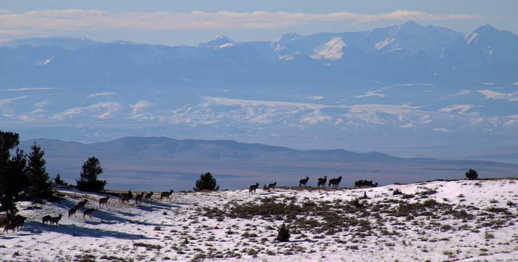
Many animals call this land home including elk, wolverines, grizzly bears, bighorn sheep, and lynx.
Upper Blackfoot
Flowing from the western slopes of the Continental Divide, many streams and rivers feed the Blackfoot River. Its upper region is rich with history. Characterized by many rolling hills and high peaks topped with volcanic rock, heavy glaciation helped to shape much of the region. Falling west of the Continental Divide, forests are denser and greener than further east. Red Mountain is the highest peak at 9,403 feet and sits on the border of the Scapegoat Wilderness.
Lincoln, on Highway 200 and on the north banks of the river provides a base and access to much of the surrounding landscape. The Scapegoat Wilderness, reached from Lincoln, is just north of the highway. Several trailheads lead into the wilderness. Alice Creek and Copper Creek provide some of the best approach.
And in this area and south, notable mountain passes are within the Helena-Lewis and Clark, including MacDonald, Rogers Pass, Stemple Pass, Lewis and Clark Pass, and Fletcher Pass provide both trail and road passage across the Continental Divide and access to the Continental Divide National Scenic Trail.
Rocky Mountain Front
Stretching north to the southern border of Glacier National Park, the eastern half of the Rocky Mountain Front’s Sawtooth and Lewis and Clark ranges are part of this sprawling forest. Much of the area is part of the Bob Marshall and Scapegoat Wilderness areas and the larger ‘Crown of the Continent’ ecosystem.
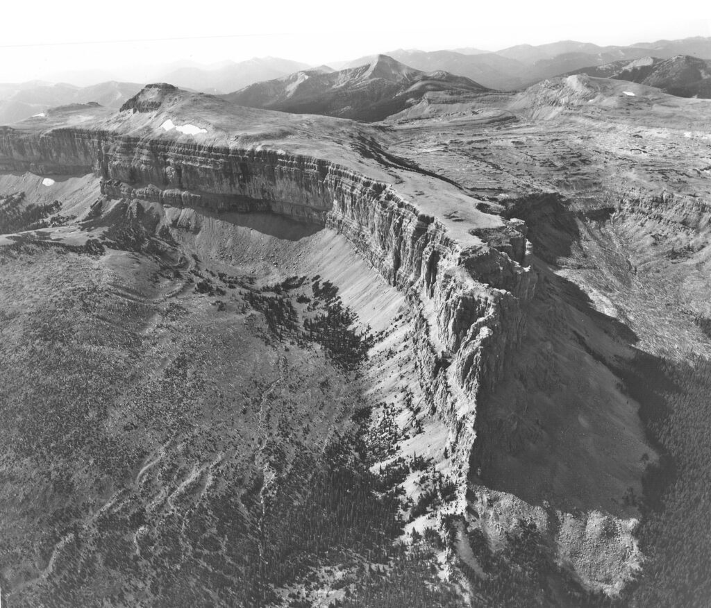
Overthrust geology, the uplift of older rock over younger rock, is easily seen across the eastern front with large limestone cliffs forming many parallel canyon systems. The Chinese Wall is the most impressive of the cliffs, averaging 1,000 feet high and spanning some 13 miles, carrying the Continental Divide across its top. Its crest, the Continental Divide is the western boundary of the Helena-Lewis and Clark National Forest.
Augusta is a starting point for visitors to the region is within easy reach of dozens of trailheads leading into the forest. Benchmark Road gives some of the best access, winding well into the mountains to the Bob Marshall Wilderness. Here, hikers and horseback riders can access trails leading to some of the most prominent features in the region, such as the Chinese Wall.
Another feature just outside the forest boundary is the Sun River Wildlife Management Area, 20,000-acres managed by Montana Fish Wildlife and Parks. In winter, visitors can see large herds of elk on the range from its perimeters, although access into the area is closed to the public from December to mid-May to protect winter habitat. Sun Canyon Road runs on its north edge and provides access to the Sun River and Gibson Reservoir, as well as numerous campgrounds and trailheads. The reservoir and river provide excellent fishing opportunities, as well as camping alongside both.
Elkhorns
An island range of inactive volcanic mountains is the best way to describe the Elkhorns. The range is roughly 300,000 acres in size, with several peaks reaching over 9,000 feet. Crow Peak at 9,414 feet is tallest, with Elkhorn Peak close behind at 9,318 feet. Mining played an important historical role, owing to many mineral-rich Boulder Batholith. Much of the range is characterized by steep gulches and canyons, with evidence of glaciation throughout. Mining is still active, with many small claims and several large mining operations.
Unique to the range is the Elkhorn Wildlife Management Unit, which is the only wildlife management unit in Montana to fall within a national forest. Creation was led by the Elkhorn Working Group, formed in response to the Fish Wildlife and Parks Commission to assist in management strategies within the range for elk and other wildlife. Many areas are closed starting in early December until May, to protect wintering grounds for game animals. Today, the Elkhorns are home to healthy populations of game animals and provide quality opportunities for hunting and wildlife viewing.
Big Belts
Running north to south, the Big Belt Range is another island range of the Helena-Lewis & Clark National Forest. It starts north of Helena above Holter Lake, and follows the Missouri River south towards Townsend, stretching some 75 miles. Many steep gulches and canyons line the edges of the range, opening up to the Missouri River or grasslands.
A colorful history of mining, similar to many of the other mountain ranges in the area is due to the rich mineral deposits that were located here. Native peoples of the region also used the range, and in several sites along the Missouri River petroglyphs can be found on exposed rock faces.
Recreation opportunities are abundant, with a network of trail systems and plentiful access to the Missouri and the Boulder-Baldy lakes. The Gates of the Mountain Wilderness area, a popular spot for backcountry recreation is on the north segment.
Mount Edith 9,504’ and east of Townsend is the highest point.
Boulder Mountains
Located just south of Helena, the Boulder Mountain Range extending from the Helena to Butte,
provides excellent recreation opportunities. Extensive mining took place here. The range carries the Continental Divide National Scenic Trail.
The South Hills trail system, located immediately adjacent to Helena, is an immense network of trails on city and national forest land.
Wilderness Areas
Gates of the Mountains Wilderness Area
Along the Lewis and Clark Trail, the 29,000 acres Gates of the Mountains Wilderness Area is in the northernmost segment of the Big Belt Mountains. The name comes from a Corps of Discovery journal entry when the group passed through the canyons of the Missouri River; “from the singular appearance of this place I call it the gates of the Rocky Mountains.” It reaches from the peaks to the Missouri, where the river meanders through limestone cliffs, rising some 1,200 feet above the water. Construction of the Holter Lake Dam in 1918 raised the level of the river about fourteen feet, but much of the area remains unchanged.
Fire has played a large role in shaping the landscape within the wilderness. A large portion of it burned most recently in 2007, and the fire footprint is still easily seen on the landscape. The Mann Gulch fire, one of the most infamous wildfires in history, burned in the area in 1949 before it was designated Wilderness. What started as a normal jump by 15 smokejumpers turned tragic when the fire changed paths and overran the firefighters. Of the 15 that jumped and one fireguard who responded, 13 were killed by the fire. Today, memorials sit at the site where the firefighters fell, and several trails lead to the site. One of the most popular access points is from Meriwether Picnic Area where a trail climbs over multiple switchbacks to an overlook with interpretive signs about the fire.
Bob Marshall Wilderness Area
It was named after an eminent and legendary early day forester, Bob Marshall, a preservation pioneer and cofounder of the Wilderness Society. Upon his passing in 1940, South Fork, Pentagon, and Sun River Primitive Areas were joined to create the fifth largest Wilderness area in the lower 48, covering just over one million acres. It was officially listed with the passing of the Wilderness Act in 1964. Later the contiguous Scapegoat and Great Bear Wilderness areas were joined in and together make up the larger 1.6-million-acre Bob Marshall Wilderness Complex.
This iconic wilderness comprises hundreds of peaks of the Northern Rockies with many famous features, such as the Chinese Wall, and miles of the Continental Divide National Scenic Trail. Numerous access points line the eastern edge of the national forest, with dozens of trailheads and campsites providing opportunities for people on foot and horseback to access the extensive trail systems of the wilderness complex.
Scapegoat Wilderness Area
Designated by Congress in 1972, the Scapegoat Wilderness totals just shy of 240,000 acres. The extensive northwest border of the wilderness is shared with the Bob Marshall, and features of the Scapegoat are extensions of those found in the Bob Marshall Wilderness. Rugged ridge tops sloping into alpine meadows and heavily forested hillsides dominate the area, with many different species of wildlife calling it home. There are also numerous high mountain lakes to fish including Heart and Bighorn Lakes.
Elevations range from about 5,000 feet along the Blackfoot River corridor to the height of 9,204 feet on Red Mountain, the highest peak in the wilderness. Several campsites and trailheads are located on the fringes, and easily accessible from Highway 200 along the Blackfoot River corridor. Numerous trail systems link to hundreds of miles of trails, including the Continental Divide National Scenic Trail.
Recreation Opportunities
Through the forest, there are almost countless recreation opportunities. Hiking, hunting, fishing, and skiing are some of the prominent. The great diversity of the forest means that there is something for anyone looking to explore this landscape.
Hiking
Hundreds of miles of trails wind through just about every landscape. From short day hikes to week-long trails and longer, there is something for anyone looking to trek the forest. Trailheads dot the landscape, and most connect deep into the backcountry. Many found in the western parts of the forest lead into the Bob Marshall Wilderness Complex. Visit: Interactive Visitor Map (usda.gov) to explore the area.
Continental Divide National Scenic Trail
Following the Continental Divide, approximately 67 miles of the 3100-mile Continental Divide National Scenic Trail is found in the Helena-Lewis and Clark. The trail can be easily accessed from Rogers, Flesher, Macdonald or Stemple Pass. It offers splendid views of the landscapes of the region, as much of the route travels above the timberline Many through-hikers utilize Lincoln, 18 miles from Rogers Pass, for supplies.
Heart Lake Loop
A popular passage, this 10-mile loop trek heads into the wilderness to a beautiful mountain lake. The trailhead is accessed off Copper Creek Road, about 6.5 miles east of Lincoln. Indian Meadows Trailhead is located 8 miles further up the road where Mainline trail takes off. Heart Lake offers excellent views and fishing as well as several well-maintained campsites. Several other longer trails are accessible from the main trail, with access to the Scapegoat Wilderness. The trail is closed to mountain bikes and motorized access.
South Hills Trail System
South of Helena, the South Hills Trail System is a collection of about 50 trails. They fall on a combination of Town of Helena and Forest Service land and are maintained by staff and volunteers. Trails range greatly in difficulty and length, with several connecting with the Continental Divide National Scenic Trail. Mountain bikers are welcome.
Other area trail systems
Other popular family-friendly spots to check out near Helena include Ten Mile Environmental Trail near Rimini, Trout Creek Canyon Trail by York and Refrigerator Canyon trail leading into the Gates of the Mountains Wilderness. As with any spot on the forest, it is best to carry bear spray and know how to use it.
Off-Highway Vehicles/snowmobiling
While some areas of the forest are closed to motorized use, many other designated roads and trails are open to the use of Off Highway Vehicles and snowmobiles. OHV routes are restricted to vehicles 50 inches or less. A list of trails open to OHVs can be found on the forest’s website under, “Motor Vehicle Use Maps.”
Snowmobiling is another popular activity in the forest, with dozens of miles of trails groomed during winter. Access from the town of Lincoln as well as north of White Sulphur Springs on Kings Hill provide ample opportunity for motorized trail access during the winter months. Several road systems are groomed and maintained for snowmobiles when snow is present. Free maps are available on the Forest Service website under “Over Snow Vehicle Use Maps.”
Horse Riding/Packing
Packing has an extensive history in the forest, especially with access to the Bob Marshall Wilderness complex. Many trails lead from the edges of the into the wilderness, and horseback is often the best way to access these remote areas. Dozens of outfitters and guides traverse the wilderness through summer, bringing guests into the backcountry.
Horseback riding is also popular. Several campgrounds and picnic areas have facilities designed specifically for use with horses. Access is plentiful, especially in the Upper Blackfoot and Rocky Mountain regions with hundreds of miles of trails leading into the wild country.
WINTER
Skiing/Snowshoeing
The Forest has permits with both Teton Pass Ski Area, located on the Rocky Mountain Front and Showdown Mountain, located in the Little Belt Mountains.
Cross-country skiing:
MacDonald Pass Ski Trailhead
Located just off Highway 12 on MacDonald Pass, this trailhead provides easy access for cross-country skiing. Thirteen trails total just over 10 miles, and many are groomed by local volunteers of the Last Chance Nordic Ski Club. They are usually open from mid-December through March depending on snow conditions.
Stemple Pass Ski Trails
South of Lincoln, Stemple Pass offers access to several cross-country trails. Users can ski or snowshoe along and around the Continental Divide Trail with several loop trails leaving from the parking area. None of the trails are groomed, but the road to the trailhead is often well-cleared in winter months. Snowmobile use is allowed on some trails, but the majority are restricted to non-motorized use.
Silvercrest Winter Recreation Area
Located just south of Neihart, off Highway 89, the Silvercrest Winter Recreation Area offers several snowshoe and cross-country ski trails. Volunteers with the Silvercrest Ski Area groom and maintain these sites throughout the winter and visitors will be delighted to discover two three sided cabins, popular spots for a warming fire and lunch.
Camping
Camping is abundant within the forest, with a large number of maintained campgrounds in addition to dispersed camping. Almost all campgrounds have first come first serve policies, whereas a few group sites can be booked in advance on www.recreation.gov. Dispersed camping is popular, and many places can be found within the forest. For a complete list of campgrounds and regulations visit the Helena-Lewis and Clark National Forest’s website.
Aspen Grove Group Use Campground, located on the banks of the Blackfoot River, is just east of Lincoln. At 4,800 feet, the campground is nestled in a stand of aspen and cottonwood and is the perfect place for a group camping experience. It is close to many features, such as the Indian Meadows Trailhead and the Blackfoot River. The campground is closed seasonally but is open during the summer months. Reservations can be made up to 6-months in advance.
Park Lake Campground
Approximately 20 miles southwest of Helena, the campground is at 6,300 feet of elevation. Located just a few hundred yards from Park Lake, ample recreation opportunities are present. The lake is open to non-motorized use and has a camping area and launch. Fishing in the lake can be excellent, with opportunities for cutthroat trout and grayling. Access along the shore is plentiful, and the area is popular in the summer months. It seasonally closed due to snow and is usually open from Memorial Day to mid-September.
Cabin Rentals
Visitors can find historic cabins, historic ranger stations, and lookouts available for rental through the Forest Service. In total, there are 24 locations for rent, depending on the season. Many of them are historic buildings that have been maintained and adapted for recreational use, and most are listed on the National Register of Historic Places. While some are accessible year-round, others close in the winter or require skiing or snowmobiling the last few miles of road to access them. Many provide only basic amenities, and most do not have running water. For a full list visit the Helena-Lewis and Clark National Forest website: https://www.fs.usda.gov/hlcnf/. Reservations can be made on www.recreation.gov
Eagle Guard Station
Located west of Townsend, the cabin is in the Elkhorn Mountain Range. It was built by “Dirty Dick” and his mining partner adjacent to their mining claim. It was used by the Forest Service when the Elkhorn Reserve was established in 1908 by personnel to monitor mining and grazing permits. In 1989 restoration efforts began on the cabin, which had fallen into disrepair, and it was subsequently listed on the National Register of Historic Places.
Granite Butte Lookout
Built in the early 1930s, the historic fire lookout is on the Continental Divide southeast of Lincoln. The lookout is on Granite Butte, at just above 7,500 feet, and provides outstanding 360-degree views. The current structure replaced the original in 1962 and is a fire lookout that sits atop a 20 ft tower. It was rebuilt in 2016 after being added to the National Register of Historic Places in 2006.
Moose Creek Cabin
Located southwest of Helena, the Moose Creek Cabin was a ranger station and is likely the oldest district headquarters on the forest that still exists. The site was first used by the Forest Service in 1908 and utilized until 1928 when the headquarters was relocated to Helena. Later the site was a CCC camp and later a WWII dog training facility. Since 1946, it has been available for recreational use and underwent major renovations in 1998. Today it is available for rent.
Fishing
With many lakes and hundreds of miles of rivers and streams, there is ample opportunity for fishing. The forest is unique in that it straddles both the Upper Columbia Basin and Upper Missouri Basin so there are many different species to target whether it be by motorboat, raft, drift boat, wade fishing or on ice.
Canyon Ferry/Holter/Hauser Lake
All three reservoirs are part of the Missouri River system, dams are operated by Northwestern Energy or US Army Corp of Engineering. Together, the lakes offer outstanding fishing for trout, walleye, perch, burbot and other species. Anglers have opportunities in the summer to fish from boat and shore, but perhaps the most popular fishing is ice fishing in winter. Ice often covers a portion of these reservoirs for several months.
Missouri River
Flowing below the Big Belt Range the Missouri River is one of the premier destinations in Montana for fishermen. Rainbow and brown trout are some of the most sought-after fish, as they can grow large throughout. Many guides fish these stretches, and boat access is excellent. Shore fishing is another popular method. While some stretches can be challenging due to the size of the river, other stretches provide excellent access to wade fishermen.
Blackfoot River
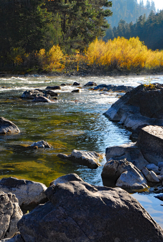
Made famous by A River Runs Through It, the Blackfoot doesn’t disappoint those looking for a picturesque Montana river. With headwaters along the Continental Divide, the river runs cold and clear from Lincoln to Missoula. Lincoln provides an excellent starting point for anglers. Much of the upper stretches offers excellent opportunities for wade fishermen, with several trout species plentiful including native Westslope cutthroat trout. Lower sections run faster, with boating or rafting being the most popular access methods. Bull Trout, listed as threatened under the Endangered Species Act, call the Blackfoot River home.
Hunting
Hunting is one of the most popular activities. Many species can be hunted, including big game such as deer and elk as well as small game such as rabbit and grouse. The wide diversity of land within the forest lends itself to extensive wildlife habitat. Arguably some of the best elk hunting in western Montana is found here, with the Elkhorn Range as well as the Rocky Mountain Front having abundant populations.
Ranger Districts
With six districts located across the forest, the ranger stations are great sources of information. Maps, guides and educational resources are available. The offices are generally staffed Mondays through Fridays from 8 a.m.-4:30 p.m. Permits for things such as firewood or Christmas trees can also be purchased here.
Lincoln Ranger District Grizzly Bear
While most ranger districts have displays and information inside, the lobby of the Lincoln district boasts the display of one of the largest grizzly bears ever seen in Montana. The bear was 12 years old at the time of its death and stood around eight feet tall weighing 830 pounds. It was the largest grizzly bear west of the Continental Divide and one of the largest in the lower 48 states. The bear was taxidermized and originally was to be displayed elsewhere in Montana. However, community members and local schools lobbied to keep the bear in Lincoln, and it was put on display in the ranger district where it stands today.
Blackfoot Pathways: Sculpture in the Wild
Located just north of Lincoln, Sculpture in the Wild showcases art that incorporates materials, natural and industrial, associated with the community’s economic and cultural traditions to create site-specific sculptures across a 26-acre woodland site. It strives to provide an environment for the creation of artwork while fostering an awareness and appreciation for the art. Art is focused on the cultural and economic history of the region, with a wide array of forms. Artists from around the world come to the site to create sculptures, with the most recent artists hailing from the UK and Ireland. Visitors can park and walk through a network of trails to tour the various sculptures, and a map is available online and on-site.
Without a doubt, the Helena-Lewis and Clark National Forest is one of the most diverse forests in Montana. With its incredible span, it contains unique landscapes. Wilderness areas provide some of the most pristine habitats in Montana. Hundreds of miles of trails wind through every landscape. The Continental Divide National Scenic Trail snakes through much of it and carries hikers across the watershed of the continent. Miles of rivers and countless lakes provide some of the best fishing opportunities in the state, and hunting in the forest draws hunters from across the state and nation.
Regardless of where one travels, the awesome scenery and landscapes are sure to impress. From the rise of the Rocky Mountain Front to the forested hills of the Elkhorns, the Helena-Lewis and Clark National Forest has something to offer for everyone.


