Jefferson’s River… The Most Distant Fountain
The Jefferson, Madison and Gallatin rivers are famous for forming the Missouri River. But of the three, it is the Jefferson that holds a lofty ranking in the annals of the Corps of Discovery. Upon leaving the confluence of the Missouri, it was this southwest Montana river that Lewis and Clark used to take them in search of a land route across the massive Rocky Mountains.
On July 28, 1805, while at the three forks of the Missouri, Meriwether Lewis, co-captain of the Expedition wrote, “Both Capt. C. and myself corrisponded in opinion, with rispect, to the impropriety of calling either of these streams the Missouri and accordingly agreed to name them … we called the S.W. Fork, that which we meant to ascend, Jefferson’s river in honor of Thomas Jefferson.

In their journals the captains named the entire length of the now Jefferson and Beaverhead rivers “Jefferson’s River,” but today’s Jefferson begins where the Big Hole (Wisdom to the Expedition) and Beaverhead rivers mix their waters, north of Twin Bridges and downstream from the entrance of the Ruby (“Philanthropy”) River. The Beaverhead originates farther south at the joining of Red Rock River and Horse Prairie Creek. The actual confluence is now under the waters of Clark Canyon Reservoir. The Jefferson River is complicated with numerous tributaries responsible for its creation. At 294 miles in length and combining all its segments, it drains the largest area of the Missouri’s three tributaries.
Lewis, on August 12, 1805, exclaimed, “the road was still plain, I therefore did not dispare of shortly finding a passage over the mountains and of tasting the waters of the great Columbia this evening. At the distance of four miles further the road took us to the most distant fountain of the waters of the mighty Missouri in search of which we have spent so many toilsome days in wristless nights.” Lewis was describing today’s Distant Fountain Spring, part of Trail Creek, flowing off the east side of the Continental Divide at Lemhi Pass. Climbing above the trickle, Lewis became the first known white man to have stepped onto and across the Continental Divide.
In terms of the most distant waters, he was a bit off; that honor is reserved for a tiny spring and Hellroaring Creek, coming off the Montana side of the Continental Divide just below 9,846-foot Mt. Jefferson at the eastern end of the Centennial Range that separates Montana and Idaho. Hellroaring Creek has a short life; it is hastily consumed by Red Rock Creek, which begins just off the Divide below Red Rock Mountain at Lillian Lake, 9,000 feet above sea level. Hellroaring and Red Rock creeks are then the furthest sources for the Jefferson as well as the Missouri.
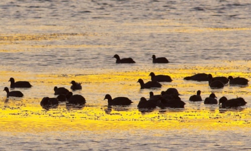
Red Rock River falls out of the mountains and courses through a most beautiful setting, the Centennial Valley and the Red Rock Lakes National Wildlife Refuge. Slowing to fill Upper and Lower Red Rock lakes, it offers haven and nesting ground for species such as the endangered trumpeter swan. Marshes, meadows, creeks, sand hills, and the two lakes make up the 65,810-acre refuge, of which 32,350 acres are designated as the Red Rocks Lake Wilderness.
If it weren’t for the wildlife refuge, few travelers would make their way through this nearly 40-mile-long valley. From the slowly disappearing town of Monida, just off of Interstate 15 and Monida Pass, a dirt and gravel road winds its way east through windswept hills of sage before easing down into the Centennial Valley. Peaks of the 10,000-foot Centennial Mountains and the Continental Divide rise abruptly on the valley’s southern flank. The 9,000- and 10,000-foot summits of the Gravelly and Snowcrest ranges guard the drainage’s north side.
The landscape and most of the activities of this 6,600-foot-high broad and flat basin haven’t changed much in the last one hundred years. Cattlemen first ventured into the place in 1876, establishing what are now some of the oldest ranches in the state.
In the 1880s, determined Yellowstone National Park tourists coming from Salt Lake City, Utah, traveled by train to Monida and then endured a two-day stagecoach trip through the valley to the Park. It was necessary to overnight at Lakeview, now the headquarters for the Refuge.
During the homestead era of the early 1900s, Lakeview and the surrounding area permanently hosted nearly 400 people. The stores, saloons, and a hotel were prosperous until the drought years and the Great Depression, coupled with the struggle against tough winters, ended the hopes of most of the population. Many of the homesteads were bought out as land was acquired for the wildlife reserve.
At the western end of the Centennial Valley, Red Rock River enters the 13-mile-long Lima Reservoir. Until this point, the river has been extending westward, now, beyond the man-made lake, it begins a northwesterly setting until it meets Clark Canyon Reservoir and the waters of Horse Prairie Creek entering from the west. The dam for the reservoir was completed in 1964. Here, Interstate 15 guides fast-moving traffic between Montana and Idaho, with most of the travelers oblivious to the historic landscape they are passing through.
Horse Prairie Creek takes its initial waters from the Continental Divide below Deadman’s Pass southwest of Clark Canyon Reservoir. Out in the sagebrush flats of this remote ranching country, it picks up Trail Creek coming off the Divide near Lemhi Pass. Frying Pan Creek, Bear Creek, and Spring Creek also contribute their waters to Horse Prairie. After meeting, Horse Prairie flows eastward toward Clark Canyon passing the settlement of Grant with its old hotel and stagecoach stop. A post office was established here in 1899 but was discontinued in the late 1950s.
All this water pools together in Clark Canyon Reservoir, then, after squeezing through a gap, it emerges as the Beaverhead River and heads toward Dillon and one of the largest of the intermountain valleys of southwest Montana and home to many multi-generational family ranches. Several creeks, including historic Grasshopper Creek on the west, as well as Blacktail Deer Creek on the east, add to the Beaverhead. Grasshopper Creek (“Willard Creek” to Lewis and Clark) was the site in July 1862 of Montana’s first major gold strike and led to the founding of Bannack, Montana’s initial territorial capital.
Dillon, the “capital” of far southwest Montana, originated because the laying of railroad tracks came to a temporary stop here. In 1880, Sydney Dillon, president of the Utah and Northern Railroad (later the Union Pacific), was building rail from Utah to Butte when he was blocked just 60 miles south of his goal by a rancher who refused to sell the right-of-way across his property.
The railroad construction crew spent the winter of 1880-1881 in a makeshift town of tents and rickety wood buildings in the Beaverhead Valley. The lengthy delay allowed for the establishment of businesses to serve the laborers. By summer, Sydney Dillon received his right-of-way and although the railroad continued northward, a town named for the entrepreneur remained.
For a while, the Beaverhead Valley was the state’s largest wool shipping area and it also profited from nearby gold, silver, and lead mines. Presently, this community of about 4,200 people is known for its historic architecture. Places such as the 1888 Dillon Tribune Building and the Metlen Hotel, finished in 1897, stand out and add to the feel of the old west town that Dillon still is.
The University of Montana Western serves as an anchor for this, the seat of Beaverhead County, a province larger in size than the combined states of Connecticut and Rhode Island.


