
History of the Continental Divide Trail in Montana
The Continental Divide spans North America. In the United States, a system of connected trails that encompasses approximately 3,100 miles of wilderness beween the Canadian and Mexican borders make up the Continental Divide Trail (CDT). At its lowest point, the Continental Divide Trail sits at about 4,000 feet in elevation while it reaches nearly 14,000 feet in other locations. The designated trail runs through five states: Montana, Idaho, Wyoming, Colorado, and New Mexico. It is a popular destination for a wide range of outdoor adventure activities, including hiking, biking, horseback riding, fishing, hunting, skiing, snowshoeing, and wildlife viewing.


Early History
Prior to European colonization, the Native Americans lived among – and relied heavily on, the resources provided by the Continental Divide. The Continental Divide Trail passes through the lands of the Chiricahua Apache, Western Apache, Zuni, Pueblo, Ute, Arapaho, Cheyenne, Eastern Shoshone, Shoshone-Bannock, Lemhi Shoshone, Apsaalooke, Niitsitapi, Salish Kootenai, Ktunaxa, and Tsuu T’ina peoples, along with others. In the southern section of the trail, in what is now New Mexico, the Zuni and Acoma tribes lived and created a path between their pueblos which has been used for thousands of years. In fact, hikers of the CDT will still use markers created by the Zuni and Acoma tribes in the form of stone bridges and cairns. In the northernmost section of the trail, the Blackfeet Nation named the mountains of the Continental Divide “Mistakis,” or “the backbone of the world.”
When European settlers arrived, they held a different view of the Continental Divide. To them, the Continental Divide was mostly seen as a dangerous obstacle to westward expansion. Families travelling west on the Oregon Trail struggled across the Continental Divide over South Pass in Wyoming, while Lewis and Clark crossed at Lemhi Pass on the Montana/Idaho border. Both of these historical sites are now part of the CDT and can be experienced by hikers in the area.
Prior to the Official Designation as the Continental Divide Trail
In 1925 the Appalachian Trail Conference (ATC) was formed. This was the first major step in officially forming the first of the now 11 National Scenic Trails found across the United States. The foundation of the ATC would soon be followed by the creation of the Pacific Crest Trail (PCT), for which planning began in the 1930s. In 1965, President Lyndon B. Johnson encouraged the creation of an entire system of National Scenic Trails in his “beautification speech.”
In this speech LBJ was quoted saying “the forgotten outdoorsmen of today are those who like to walk, hike, ride horseback, or bicycle. For them we must have trails as well as highways…. I am requesting… a cooperative program to encourage a national system of trails in our national forests and parks. In backcountry we need to copy the great Appalachian Trail in all parts of our country.”
In 1966, a man pivotal to the creation of the Appalachian Trail (AT), Benton Mackaye, introduced the idea of a trail spanning the country along the Continental Divide.
In 1968, a few years after Johnson’s speech, the National Trails System Act passed, officially designating the Appalachian Trail and the Pacific Crest Trail. The act also made it so 14 other possible routes could be studied as possible future scenic trails. This act also ensured that future National Scenic and Historical Trails could only be officially authorized by an act of congress.
In 1978, the Continental Divide Trail was officially designated. This trail would incorporate 1,900 miles of pre-existing trails and 1,200 miles of newly developed trail to complete the path. At this time the Unites States Forest Service was put in charge of trail development in cooperation with the National Park Service and the Bureau of Land Management. However, the official foundation of the CDT did not come with any direct funding for the creation of the trail itself.
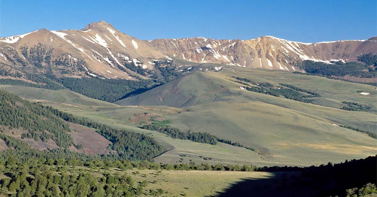
Eighteen Mile Peak in the Beaverhead Mountains near Lima, Montana | Rick and Susie Graetz
Development of the CDT
In 1981, the CDT comprehensive plan was drafted in the hopes of producing an overarching plan to develop the trail in such a way as to agree with the original goals of the National Scenic Trail System. This was to be done while at the same time preserving and using natural and cultural resources along the way. This plan used a 50-mile corridor on both sides of the Continental Divide itself to contain the location of the final trail route.
In 1995, the Continental Divide Trail Association (CDTA) was formed with the intentions of encouraging enthusiasm for the completion of the CDT at both a private and public level. A few years after its formation the CDTA set the goal of finishing the CDT, initiating its efforts through the creation of strategic completion plan that outlined all necessary costs and work to finish the CDT. This was the first time that a comprehensive plan for the project was completed. By 2011 the CDTA had organized over 12,000 volunteers in its efforts to complete the trail. Unfortunately, in 2011 the CDTA ran into difficult times and ceased all operations.
The loss of the CDTA left a hole where there had previously been coordination and direction in the development of the cross-country trail. Luckily, the dedicated workers who had previously been a part of the CDTA worked with the past partner organizations to continue its development. Then, in 2012 the Continental Divide Trail Coalition (CDTC) was formed to fill the hole and continue with the CDT project.

Lemhi Pass | Rick and Susie Graetz

Rocky Mountain Front - Nilan Reservoir | Rick and Susie Graetz
The Continental Divide Trail Today
Efforts to finish the trail are full steam ahead. This will require the creation of some new trails along with acquisition of land along roughly 158 miles of the route. In 2020 the CDTC completed a major project by adding signs to mark the trail every few miles or so. The CDT is unique in its variety of official alternate routes available to thru hikers. Unlike other national scenic trails, hikers on the CDT are both encouraged and/or forced to pave their own path based on personal preferences and fire/snow conditions along the main trail. The alternate routes also help keep the experience more wild for those daring enough to attempt a thru hike.
Continental Divide Trail Coalition
The Continental Divide Trail Coalition (CDTC) was founded in 2012 with the mission to “complete, promote, and protect the Continental Divide National Scenic Trail. The CDTC will do this by building a strong and diverse trail community, providing up-to-date information to the public, and encouraging conservation and stewardship of the trail, its corridor, and surrounding landscapes.“ The CDTC provides a vast array of information regarding the 3,100 mile Continental Divide Trail including community information, thru-hiking, section hiking, trip planning resources and more! For complete information about the trail, please visit the Continental Divide Trail Coalition website.
Visit the CDTC