Planning & Preparation for Thru-Hiking on the Continental Divide Trail

The Continental Divide National Scenic Tail (CDT) traverses 3,100 miles from Mexico to Canada and crosses through Montana, Idaho, Wyoming, Colorado and New Mexico. The CDT is the longest trail of the Triple Crown of long distance thru hikes in the US, the others being the Appalachian Trail which runs from Georgia to Maine, and the Pacific Coast Trail which runs from California to Washington. Designated in 1978, the CDT is often described as generally very rugged and more remote than other thru-hiking trails. Spanning some of the most spectacular scenery in the United States, hikers will experience a variety of sweeping landscapes from lush forests to deserts home to incredible ecosystems of diverse plants and animals. Traveling through the homelands of more than a dozen Native American tribes who have cared for the land for thousands of years, the trail also connects ghost towns of the recent past with vibrant communities of the present.
Typically referred to as the Montana/Idaho section of the journey, the Continental Divide Trail winds along the Montana-Idaho border for much of the distance between Yellowstone NP and Chief Joseph Pass. Approximately 800 miles of the CDT are in the Montana/Idaho portion of the trail, with an additional ~620 miles in Montana. In Montana you may find your route diverges from the official trail depending on the season, as the snow melts in the spring and the wildfires flare up at the end of summer. As the trail continues to be more formalized and marked, you should expect to do road walking and highway crossing in the Montana portion of the CDT. You may even find several alternative trails beneficial during your journey.

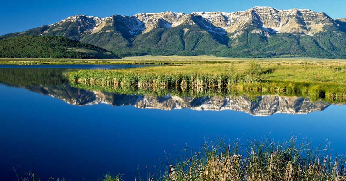
Chinese Wall | Rick and Susie Graetz
Maps / Navigation
Experienced thru-hikers who may have done the Appalachian or Pacific Crest Trails will quickly find there are a lot of variations and route choices to make along the Continental Divide. Even purists who aim to stay on-trail will find that realities of weather, resupply needs, trail closures and more may cause variations in route as they go along. Some also choose to take alternative routes, bypass certain segments, or add other stops along their journey. The CDT very much offers the ability to “choose your own adventure!"
Popular Alternative Routes
Popular alternative routes within the Montana portion of the Continental Divide Trail include:
- Spotted Bear Alternate – diverges after the Chinese Wall
- Chief Mountain Route – near Many Glacier
- Anaconda Cutoff – a shorter route that passes through the Gateway Community of Anaconda, Montana
Gap Routes
In addition, there are several Gap Routes, which are informal connections between the formalized trail portions, that make for a continuous route for thru-hikers on the Continental Divide. While traveling through Montana, it is important for hikers to note that there are several highway and interstate crossings to be aware of over I-90, I-15 and other smaller highways.
Northern Terminus - Waterton or Chief Mountain?
There are two places to start or finish the North end of the trail (depending on the direction you are heading)– Waterton Canada or Chief Mountain. Both locations are considered “official” termini of the Continental Divide National Scenic Trail. The formal CDT trail split occurs near the Iceberg Lake trailhead close to the Many Glacier Lodge.
On the Waterton route, you will hike in the Waterton Lakes National Park of Canada along Upper Waterton Lake to Waterton Park. On this route you will hike across the Canadian-US Border so you must plan accordingly. Southbound hikers must check in with border patrol agents at Goat Haunt or will be fined for not doing so. Northbound hikers must call Canadian customs upon arrival in the Waterton Townsite. We recommend careful planning regarding this border crossing and to remember to carry your passport. More information may be obtained from Glacier NP’s website, or the Continental Divide Trail Coalition’s Planning Guide.
On the Chief Mountain route, the trail begins/ends at the Chief Mountain border crossing on the US-Canada Border. This option is a good route for those not wanting to cross into Canada and for hikers concerned about snow travel.
These variables in route planning make it less straightforward to plan resupplying and mail-drops along your CDT journey, however, Southwest Montana boasts many community options for resting and restocking.
Gateway Communities and Other Stops of Montana Resupplying & Montana Towns Along the Trail
All four of Montana’s Continental Divide Trail Gateway Communities are in Southwest Montana and look forward to welcoming you as you venture through on your hiking journey! Our Gateway Communities are well-established stop-overs that provide the needed resources for receiving resupply boxes, zero day resting, and resupplying. You will find lodging, showers, restaurants, stores and more in these Gateway Communities. Additionally, each of the Montana communities listed have the resources to receive resupply boxes.
Anaconda
23 Miles North of Trail
Historically known for being the site of the smelter for the Anaconda Copper Mining Company of Butte, Anaconda is frequently spoken about as a favorite resupply stop along the trail. While Anaconda is located 23 miles from the official trail, the "Anaconda Cut-Off" is popular among hikers and leads you directly through the Anaconda community. Beyond normal community amenities, you will also find a Hiker Hut in Washoe Park and Pintler’s Portal Hostel, as well as the larger chain grocery store, Albertsons.
Butte
3.7 Miles East via Maud S Trail
Known as 'The Richest Hill on Earth', Butte was a bustling mining town at the turn of the 20th century and was the largest city west of the Mississippi between Chicago and San Francisco. Today, visitors of Butte are still surrounded with reminders of its rich history. In Butte you will find access to desired amenities and shopping opportunities, including Safeway, Bob Wards and St. James Hospital. The Butte KOA Journey offers wifi, camping, supplies and more. Additionally, there are many restaurants and hotels in the area.
Helena
16 Miles East of Trail
Helena, Montana’s state capitol, is the other city-like Gateway Community along the Montana portion of the trail. You will find larger grocery stores such as Safeway, and several sporting goods stores including – Montana Outdoor Sports, The Basecamp, and Capital Sports.
Lincoln
18 Miles Southwest of Trail
Lincoln, formerly Lincoln Gulch, was named in memory of our former US President Abraham Lincoln in after his assassination. Thru-hikers will have several motel options, as well as shower facilities at Hooper Park Campground which is right in town. Grocery stores are more limited as Lincoln is much smaller than the other three Montana Gateway Communities, however, D & D Foodtown and Mountain View Co-op offer basic grocery items.

Blackfoot River Below Lincoln | Rick and Susie Graetz
Other Resupply and Mail-Drop Towns
In addition to our Gateway communities, there are several other popular resupply and mail-drop towns and places along the way with services for CDT hikers.
Lima
15 Miles North of Trail
Many find Lima is a good place to rest. Mountain View Motel will shuttle hikers from the trail to motel and back and will hold your resupply box for you. Lima also has a restaurant and gas station.

Centennial Range and the Continental Divide | John Lambing
East Glacier
On Trail
The community of East Glacier Village offers several lodging options, restaurants and a couple of small grocery stores including, Glacier Park Trading Co, Bear Track Travel Center and Brownies Grocery.
Some other locations hikers may choose to stop at while in Montana that are on-trail are Two Medicine Campground and Many Glacier Campground, however they are very popular, so book ahead! Locations that are off-trail include: West Yellowstone (9 mi east), Darby (31 mi north), Wisdom (25 mi east), Sula (18 mi north), Elliston (7 mi west), and Augusta (30 mi east).
Beyond using the General Delivery strategy for sending resupply boxes to the above-mentioned Gateway Communities and towns, the following locations may also be an option. Please confirm with these locations prior to mailing anything:
Benchmark Wilderness Ranch
1.5 Miles East of Trail outside of Augusta, MT
This Montana Guest Ranch offers cabin rentals, shuttle service to Augusta, tent sites and showers, as well as holding pre-shipped boxes at the main lodge.
Choosing a Starting Date and Direction
Choosing a starting date for your hike is dependent on the route you decide to take. Route options include hiking southbound (SOBO), northbound (NOBO), or choosing a “flip flop” route. Additionally, some decide to break the trail into sections.
Going SOBO on the CDT
- Typically start mid-June to early July once there has been enough snow melt to safely traverse the passes in Glacier NP, and be through San Pedro Parks, NM by November
- Because of the later start date, your pacing needs to be such that you can get through the Colorado sections before winter snow comes, typically in early October. Also, you will experience cooler nighttime temps as you head south.
- Fewer people choose to do this hike SOBO, so thru-hikers regularly report that they have the trail more to themselves. Additionally, you will experience hitting the trail towns in non-thru-hiking season which may allow for better chances of finding hotel and hostel vacancies.
- There is less rush to finish, however, you will be dealing with decreasing daylight as you go
- Going SOBO makes for starting on the difficult portions of the trail, therefore, prior training and body-conditioning is advised
Going NOBO on the CDT
- Most start mid-April through mid-May and be at the Canadian border by late September
- While able to start earlier in the year, NOBOs still have to plan around the seasons and account for desert temperatures and snowpack conditions in Colorado, as well as the likelihood of early season snow in Glacier NP (snow typically hits in late September).
- More people choose to head NOBO on this route, and because of this there are likely more chances to hike with others
- Difficulty builds gradually, so body has more time to adapt to physical conditioning needed for the hike
- Many say ending at the north end is epic. We may be slightly biased in Montana, but Glacier is quite epic.
Flip Flop Hiking along the CDT
This may be a good alternative for those wanting to avoid as much snow travel as possible. The CDT Coalition has outlined several popular Flip Flop options which can be found in their Planning Guide.
Section Hiking the Continental Divide
While many find it ideal to do the CDT as a thru-hike, breaking down the CDT into sections can also provide hikers with several advantages, including:
- Avoiding flood and fire closures by planning to hike flood and fire prone sections at times when these hazards are less likely to occur,
- Experiencing a more leisurely hike or stopping at other places that would be more difficult to do on a tight thru-hike schedule, and
- Enjoying sections during their “peak” beauty, such as wildflower season in Glacier
For those looking to spend less than 3-4 months on the trail, there are also some really wonderful sections for shorter duration backpacking trips.
Ultimately, this debate of which approach is best will ultimately end in doing what works best for you and your schedule.
Safety Considerations
The CDT is a challenging thru-hike and is not suitable for most beginner backpackers or hikers. Beyond the physical and mental challenges of tackling this hike, there are many safety considerations to keep in mind when hiking.

Continental Divide | Rick and Susie Graetz
Weather
Snow/Cold Temperatures:
Due to the length of the trail, regardless of going NOBO or SOBO, you will likely encounter snow. Hiking in snow is physically demanding, and may necessitate the need to have micro-spikes, an ice axe, and other snow-related hiking gear. Additionally, other safety risks include avalanches, hypothermia, and increased likelihood of sunburn.
Sun/Hot Temperatures:
Conversely, you may encounter extreme sun and very hot conditions. As such, hikers should be aware of symptoms of intense sun and heat exposure, sun burn, heat exhaustion, and heat stroke.
Lightning and Adverse Weather Patterns
Hikers should be educated on reading weather patterns and take appropriate steps when lightning, hail, flash flooding, or other dangerous weather events begin to emerge.
Health
Hikers may experience a range of health-related issues including overuse injuries, altitude sickness and other unplanned emergency medical situations. Carrying a Personal Locator Beacon, or other Emergency Beacon is an intelligent decision.
Additionally, hiking with basic first aid supplies is paramount, as is caring for blisters.
Water
Water treatment planning is very important, as is staying hydrated. Improperly treated water can cause illness such as giardia. Depending on the season, some river crossings may be necessary to continue hiking. Hikers should be educated on proper river crossing methods and make smart decisions that limit situations of drowning or other water-related injuries.
Wildlife
You will encounter wildlife on this hike; therefore, it is advised to be well educated on the different animal encounters you may have. Along the Montana portion of the trail, it is most likely you will encounter grizzly bear, black bear, moose, and elk. Consider carrying bear spray or hiking with partners.
Beyond these safety considerations, it is also important to know how to use the gear you have, such as snow-related hiking gear, bear spray and more, before setting out on your adventure.
Be Bear Aware
Black Bear | Tempest Technologies
Other helpful travel tips through Montana
Be aware of local fire bans, fire related closures, and other requirements of the various public lands you will be traversing.
Bear canisters or utilizing bear-proof hanging methods is advisable in bear country. Some areas, like the Bob Marshall Wilderness Complex and Glacier National Park, require use of bear-proofing methods.
Permits
Instead of getting one long-distance permit, you will need to get area-specific permits for hiking. Throughout the Montana section, you will need:
- Glacier National Park – backcountry permits for camping and be prepared to make alternative camping arrangements as campsites can become full
- Blackfeet Reservation (south of Glacier NP)
- Yellowstone National Park – backcountry permits for camping. Walk-up permits are possible, but not recommended to rely on
- Self-service wilderness permits – are required at some National Forest Wilderness Areas and will be available at certain trailheads. If you see a station, please fill out as this helps with trail funding.
Leave No Trace
Please do your part to help ensure that the trail remains beautiful and wild for generations to come and familiarize yourself with the Seven Principles of Leave No Trace:
- Plan Ahead and Prepare
- Travel and Camp on Durable Surfaces
- Dispose of Waste Properly
- Leave What You Find
- Minimize Campfire Impacts
- Respect Wildlife
- Be Considerate of Other Visitors

Royce Engstrom on the Continental Divide Trail | Rick and Susie Graetz
That's a Wrap!
We look forward to seeing you in Montana as you hike along the Continental Divide and stop in our many wonderful communities along the way!
There are many online resources available for your CDT planning, however, we highly recommend looking at the CDT Planning Guide that is published by the Continental Divide Trail Coalition. Along with the guide, the Coalition also offers a wealth of information that is worth checking out as well as the inspirational official list of people who have completed the CDT! We hope that one day, we will see your name on that list as well!
Happy Trails!


