Potosi Trail

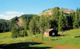
An ideal trail for day hikers and extended trips out of Potosi Campground.Potosi Trail (303) climbs through several steep switchbacks for the first mile. Once on top of the ridge looking down into the South Willow Creek drainage, it flattens out, passing through a large open area. A mile before intersecting with the Rock Creek Trail 304, the Potosi Trail begins gradually to climb again. Just past here, it shoots up at a consistently steep grade until it terminates on a ridge top, connecting with Trail 351. Trail 351 is a very short trail, which serves to join Potosi Trail with the Albro Lake and North Willow Creek systems.The possibilities for day and extended hikes or rides abound with this trail. Following Rock Creek Trail 304 brings you back down to the South Willow Creek Road about a mile from Potosi Campground. This is a great day hike or bike loop, 6 miles round trip. Nearby Potosi Campground, which makes an excellent base for forays into the Tobacco Roots. The campground offers 15 campsites, drinking water, and toilets. Anglers will want to take advantage of the chance to fish South Willow Creek, which runs through the campground. Also, hike up to one of the several lakes (Hollowtop, Deep, Skytop, and Albro) accessed by the trail. The trail itself passes through open country with breathtaking views.Length: 6.2 miles round trip. Moderate difficulty.Trail Begins: Near Potosi CampgroundTrail Ends: Junction with Trail 351USGS Map: Potosi Peak


