MONTANA’S LEE METCALF WILDERNESS
An unusual federally designated wilderness, the Lee Metcalf Wilderness has four distinct units spread across the Madison Range and Spanish Peaks in Southwest Montana. Trails span 300 miles of the total 259,000 acres. Twenty-eight trailheads provide entrance to alpine and canyon hikes, camping, kayaking, hunting, fishing, and whitewater rapids. The Forest Service manages the Monument Mountain, Spanish Peaks, and Taylor Hilgard Units throughout the Gallatin and Beaverhead-Deerlodge National Forests. Bear Trap Canyon, the smallest unit, is managed by the Bureau of Land Management.
Numerous access points reach into this wild country from both the Madison and Gallatin Valleys.
Lee Metcalf, Montana’s first native-born senator, spent decades conserving Montanan watersheds, air quality, and wild areas. Across his lifetime, he became a figurehead for grassroots conservationists wanting to preserve Montana’s undeveloped lands. Moreover, Metcalf cosponsored integral environmental laws like the Clean Air Act of 1963 and the Water Quality Act of 1965. After Senator Metcalf’s unexpected passing in 1978, his efforts to fight for conservation came to an end. Yet, his legacy lives on. In 1983, Congress passed the Lee Metcalf Wilderness and Management Act.
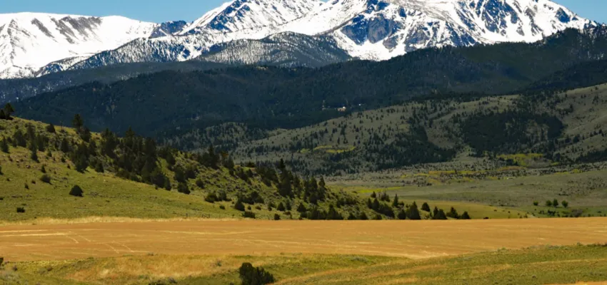
In part due to Southwest Montana’s geographic variability, the Lee Metcalf Wilderness is home to a great diversity of landscapes, elevations, and biological communities. Elevations range widely, from 4,500 ft in canyon country to about 11,300 ft in the Taylor Hilgard unit. Additionally, the Lee Metcalf is a vital component of grizzly bear habitat in the Greater Yellowstone Ecosystem.
Towering alpine peaks, vast meadows, and deep canyons dominate the landscape. Wildlife is abundant throughout the Wilderness, which includes bighorn sheep, mountain goats, cougars, wolves, elk, moose, bald eagles, grizzly bears, and black bears. Trout populations flourish throughout the units’ many streams, rivers, and lakes.
Drastic differences in temperature and precipitation contribute to the formation of diverse habitats. The Bear Trap area receives an average of 11 inches of rainfall compared to a 60-inch average in the Madison Range.
The Bear Trap Unit is characterized by the Madison River’s whitewater rapids and 1,500-foot-tall cliffs. Nine miles of the Madison River run through Bear Trap Canyon, from Ennis Lake to the Madison River Bridge. The 6347-acre stretch is home to the notable Class IV-V Kitchen Sink rapid.
Open year-round, Bear Trap Canyon Trail offers an enjoyable day hike and provides access to numerous fishing and camping spots. A popular turnaround is a seven-mile round-trip to Bear Trap Creek. The entire trail is approximately 15 miles round-trip, concluding at the Madison Dam Powerhouse. The trail entrance is at the end of Bear Trap Canyon Access Road. Floater access is located at the south end of the canyon at the Wilderness Boat Launch.
Monument Mountain country is characterized by high plateau-like mountains sprinkled with alpine forests and rolling meadows. Directly bordering the Northwest corner of Yellowstone National Park, 33,000 acres of protected wilderness expand the integral greater Yellowstone area habitat. The actual Monument Mountain is about 10,074 ft in elevation.
Cross-boundary trails, such as the Bacon Rind Trail, begin in Yellowstone and end in the Lee Metcalf Wilderness. A 10.2-mile there-and-back trail climbs about 2,400 ft in Grizzly country, across swift rivers and steep slopes. The Bacon Rind Trailhead, located off Highway 191 in Gallatin Gateway, MT, offers visitor parking.
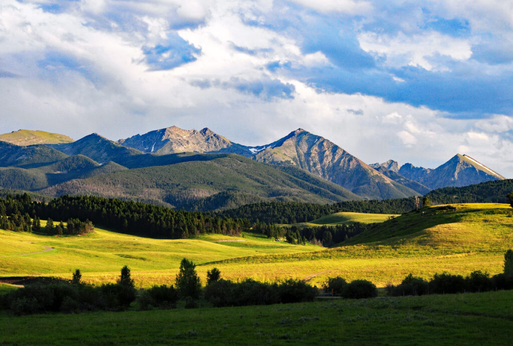
The Spanish Peaks Mountains unit contains 76,000 acres of high alpine views and cirque lakes. Ancient glaciers carved deep, U-shaped valleys, knife-like ridges, and 25 peaks above 10,000 feet.
Bordered in the East by the Gallatin River, recreationists take advantage of ample fishing, wildlife, and climbing opportunities. Many trails within this unit are challenging and are recommended for experienced hikers.
However, the Lava Lake Trail is a more accessible option for those wanting to enjoy the Spanish Peak’s expansive scenery. 5.5 miles out and back, the Lava Lake Trail begins in thick lodgepole forest near summer cabins, through Cascade Creek Canyon, and up to a fantastic view of Lava Lake surrounded by the towering Spanish Peaks. Parking is available near the Lava Lake Trailhead off Highway 191 in the Gallatin Gateway area.
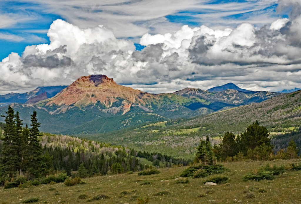
At an impressive 141,000 acres, the Taylor Hilgard unit is characterized by the sedimentary Taylor Peaks in the North and the rugged Hilgard Peaks to the south. Outside of the Beartooth, Hilgard Peak is the highest peak in Montana at 11,316 ft.
Similar to the Monument Mountain Unit, the Taylor Hilgard region has rough terrain and a high concentration of bear activity. The isolated nature of the unit has prevented most of the difficult-to-traverse landscape from becoming a high-traffic area for skiing and climbing. Access is minimal, especially during the winter.
The strenuous hike up the Sphinx Mountain Trail is worth the incredible views and unique geologic formations. Sphinx Mountain Trail follows Bear Creek for several miles, then switchbacks up the gulley until the summit ridge. Round-trip, the hike covers approximately 12.5 miles with an elevation gain of 4,500 feet. Camping spots are recommended alongside the first few miles near the creek. Trail access is off of Bear Creek Campground and Trailhead, a decent drive from Highway 287.
Physical maps can be found at the BLM Field Office in Dillon, and USFS ranger stations in Bozeman, Ennis, Livingston, and other surrounding towns. Detailed digital maps are often available by unit, on websites such as publicland.org, fs.usda.gov, fws.gov, and blm.gov.