Montana’s Welcome Creek Wilderness
One of Montana’s smallest wildernesses, Welcome Creek Wilderness encloses 28,315 acres on the Lolo National Forest and is in the traditional homelands of the Salish peoples.
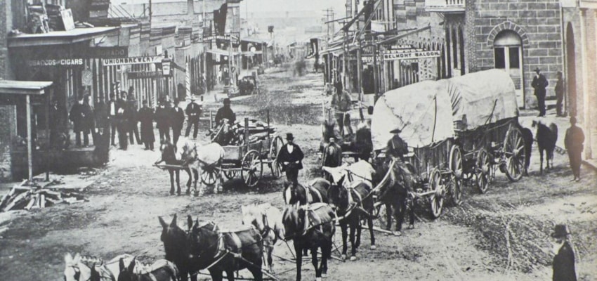
Senator Lee Metcalf of Montana worked with conservationists to designate Welcome Creek as part of the Endangered American Wilderness Act in 1978
Steep, rocky terrain challenges even the most adventurous of backcountry hunters, anglers, and hikers. Located southeast of Missoula, it is best entered from the Rock Creek Road, a few miles east of Clinton. Florence, Hamilton, Lolo, and Stevensville can also serve as starting points for longer hikes on the east side from the Bitterroot Valley.
Steeped in rich Montanan history, Welcome Creek produced one of the largest gold nuggets in Montana, at 1.5 pounds. After a brief mining stint, the heart-shaped wilderness became a haven for outlaws desperate to escape custody. Decayed remnants of past gold mining and outlaw hide-outs can be found throughout the region.
Hidden amongst a patchwork of private and public lands, Welcome Creek Wilderness is an island of refuge for anglers, hunters, hikers, and backcountry skiers. Nearly 30 miles of trails sprawl across this wild country. Big and small game utilize it for winter and summer range habitat.
Open, grassy slopes provide an integral winter range for deer and elk. Additionally, summer range habitats have resources for bobcats, raccoons, mink, weasels, elk, and pine martens. Grizzlies, black bears, and mountain lions are known to traverse the mountainous terrain occasionally.
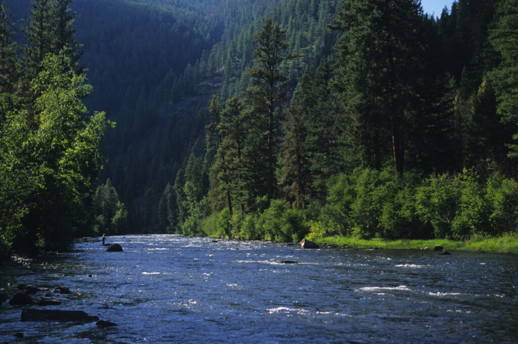
Rock Creek, a famous blue-ribbon stream, borders the eastern half of the Wilderness. It was protected by the ESAW Act in 1978 and boasts impressive native trout populations.
Popular hikes include Welcome Creek Trail and various parts of Solomon Ridge Trail.
In August 2022, a lightning-caused forest fire, dubbed the Solomon Fire, burned approximately 350 acres, resulting in the prolonged closure of several trails and the Welcome Mountain Trailhead. The fire opened up more distant viewpoints that backcountry users can now enjoy.
While the area does not contain lakes, high cliffs, or cirques, the landscape shows dramatic canyons, exposed ridges, and forested slopes. Steep, rough breaks are covered with mature stands of conifers, including lodgepole pines, larch, spruce, and fir.
The highest point in these mountains is Welcome Mountain, at 7,723 ft.
Day hikers and big game hunters commonly utilize Welcome Creek. Due to challenging terrain, camping sites are limited for the average visitor. While the Wilderness ‘ waters are an integral habitat for trout, reaching a quality angling spot requires hiking.
The Sapphire Divide region provides ideal late-season snow conditions for cross-country skiing; however, checking local avalanche reports is necessary.
Trail use varies by season, with the summer and fall seeing a growing popularity. Horseback riding is allowed, but caution is advised on steep ground.
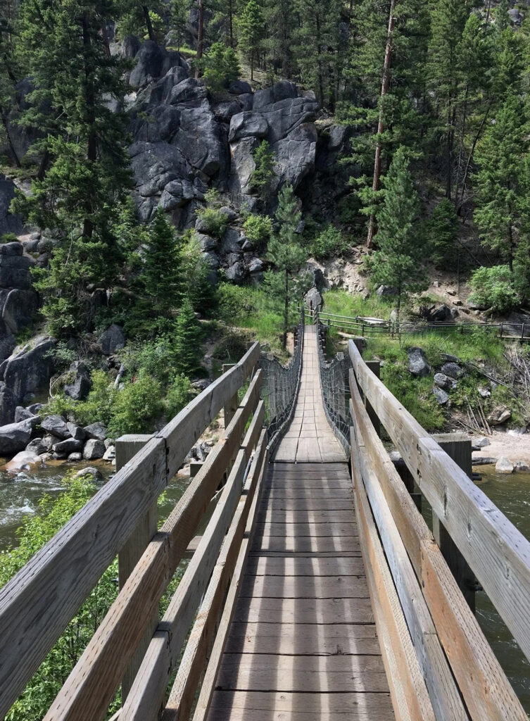
Welcome Creek Trail is considered one of the most accessible and popular ways to enjoy this wild country. Beginning on Rock Creek Road 102 at the swinging footbridge, the rocky seven-mile trip reaches the Bitterroot divide near Cleveland Mountain. The trailhead for this trail has an adequate place to park vehicles not hauling trailers.
Solomon Ridge Trail is challenging due to its steep terrain. This approximately 19-mile loop hike starts on Rock Creek Road 102, at the Solomon/Spring Creek Trailhead, and ends at Bitterroot Divide Trail marker 313. Characterized by past wildfires and intimidating ridges, Solomon Ridge Trail winds around the Wilderness border, inside, and then up to the divide.
To enjoy Solomon Ridge trails and grand views in a far shorter amount of time, consider traversing from Rock Creek to Solomon Ridge, which is about 7-8.5 miles, or longer depending on how far you adventure into the wilderness. Access points vary, but hikers can enter around the Solomon Fishing Access point and cross Rock Creek.
A comprehensive map of Welcome Creek Wilderness is available online on AVENZA Maps for $4.99 USD, or physical copies in the surrounding Lolo National Forest Ranger/Information Stations. Ranger stations are located in Missoula, Huson, Plains, Superior, and North Seeley Lake.