Helena Montana
Community Overview
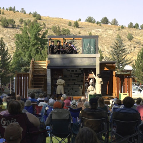
Tucked away in the foothills of the Rockies, encompassed by mountains and history, lies Montana's capital: Helena, the "Queen City of the Rockies." In 1864, four prospectors (called the Four Georgians) struck it rich in a gulch off of Prickly Pear Creek that they had named Last Chance Gulch. Helena quickly grew from an empty gulch to a bustling city. By 1888 legend has it the city was home to about fifty millionaires. Today, Helena is a vibrant and active city with a fascinating mixture of past and present. Between the theaters, farmer's market, symphony, fair, and Helena's signature Alive@Five gathering, anyone bored in Helena has only themselves to blame. Even without the events, visitors to Helena can spend many happy hours wandering around downtown. The Four Georgians' Last Chance Gulch has been transformed into the city's Main Street and a beautiful outdoor walking mall, bursting with unique boutiques, restaurants, and coffee shops.
The mining camp became a city under the direction of men with the funds to make things last, and the ornate Victorian stone and brick buildings that populate Helena serve to make it perhaps the grandest and oldest of Montana's grand, old cities. In addition to the spectacular architecture up and down the walking mall, there are a number of other buildings you don't want to miss. The Gothic St. Helena Cathedral and Moorish Revival Civic Center tower over downtown. The Original Governor's Mansion contains twenty rooms restored to their turn-of-the-century elegance, and the Montana State Capitol building features a beautiful rotunda and paintings of momentous Montana events.
The Last Chance Tour Train starts near the capitol outside of the Montana Heritage Center and provides hour long tours of Helena, showcasing the spectacular architecture, and the fascinating and often quirky history of this unique city.
For the outdoor enthusiast, Helena presents an array of opportunities. Just a few miles away, the Missouri River flows through Holter Lake, Hauser Reservoir, and Canyon Ferry Reservoir, all perfect for fishing, swimming, boating, water-skiing, and more. Mount Helena City Park offers hiking and biking just south of town. Spring Meadow Park is the perfect place to swim and picnic on a hot summer's day.
Vibrant and dynamic, Helena offers a unique and enjoyable experience for everyone.
Community Info
Helena Elevation: 4,089'
Helena Population: 32,091 (2020)
County: Lewis & Clark
Helena Area Chamber of Commerce Visit Helena Webstite 3 Day Helena ItineraryIn the Helena, MT Area:
Get Out and Explore.
Weather Forecast for Helena MT:
88°
Partly CloudyHelena—The Capital Town

Beauty abounds in all of Montana’s towns. That’s just the nature of this piece of the Northern Rockies and Great Plains and it’s hard to go wrong. But to many, the capital town—Helena—is in the finest setting of any Montana community.
The town’s location just off the east slope of the Continental Divide provides a vista for sunsets that can set fire to the sky. One evening a couple years ago, the atmosphere seemed to be preparing itself for a grand spectacle. Out over MacDonald Pass, a red disc began its fading ritual. Overhead, the cloud stuffed sky gave way to a clearing on the west, making room for the setting sun to spread its light. We reckoned it would be worth the effort to climb several hundred feet up Mount Helena’s north slope to get the full effect of the promised performance
As the sun made its exit, bits of orange, yellow, red and purple tinted the western horizon; but the anticipated flame of color didn’t spread. Instead, a soft brilliance of gold illuminated the clouds and washed over the town and surrounding mountains and hills. The richness and warmth intensified, filled the air and held. No cameras at hand, the vision etched in our memories, we sat in awe … what a beautiful place, this town called Helena.
On a more recent ascent of Mount Helena, we sat comfortably on a north-extending ridge that falls out just below the cave-pocked limestone cliffs. With note pads in hand, we tried see if we could tell Helena’s story from our lofty perch. At this vantage point, it’s obvious the Prickly Pear is no small valley. Looking toward the northern horizon, it’s anywhere from 10 to 15 miles across, and from the west flank of the Spokane Hills, 17 miles are covered before the valley constricts to take Hwy 12 up MacDonald Pass and over the Continental Divide.

On July 19, 1805, Captain William Clark of the Corps of Discovery wrote in his journal:
“… my feet are verry much brused & cut walking over the flint, & constantly stuck full of Prickley pear thorns, I puled out seventeen by the light of the fire tonight …”
From this miserable happening came the name Prickly Pear Valley, sometimes called the Helena Valley.
But long before Lewis and Clark laid eyes on the Helena area, the great Indian Nations, migrating from the west on their way to the bison hunting grounds on the prairie, found a plentiful food supply here. The Blackfeet-Piegan people called the valley Tona, or “game pocket.”
Our description commences as far to the left as possible where a combination of springs and runoff, above the old mining camp of Rimini, give Ten Mile Creek its start. From this rugged village, it flows out of the mountains arriving at the capital city from the west, skirting Helena’s southwest side, then reaches into the middle of the valley. Somewhere near the former Mountain View School, it connects with Prickly Pear Creek.
Looking out from this ridge on July 14, 1864, one would have noticed four men making their way down Ten Mile Creek (the route of today’s Hwy 12) into the valley. Heading up what is now the main street of Helena, the Four Georgians, as they were mistakenly called, set up camp and immediately began panning the stream gravels for gold. The rest is history—“Last Chance Gulch and Camp” was born. In late October, citizens of this rapidly growing settlement, feeling the title “Last Chance” was too daunting, wanted a new name. Ideas were bantered, and finally John Summerville came up with the name Heleena in honor of a town in Minnesota. The two Es remained until 1882, when it finally became Helena.
Just north of where the “Four Georgians” entered the valley are the Scratchgravel Hills—an isolated grouping of rises dressed in a mixture of open parkland and ponderosa pine. Prospectors raked and plowed the landscape’s thin layer of gravel to collect gold nuggets. The method was called scratching the gravel and the name stuck to the area.
Hidden in the forests of the Continental Divide are two mountain gaps leading into Helena, MacDonald Pass (Hwy 12) to the far left and Mullen Pass on its right. In 1870, a man named Dundhy built a toll road over MacDonald. His use of log corduroying to cover the muddy spots made travel easier for horse-drawn stagecoaches and therefore, it became the main route to and from the capital city. The name came from Alexander MacDonald, who managed the tollgate. Mullen Pass was named for Lt. John Mullen who, in the early 1860s was in charge of building the military road between Fort Benton and Walla Walla, Washington. The road ascended the pass from somewhere on the north side of the Prickly Pear Valley.
Moving your eyes a bit more to the right, the big dark tree covered bulk of 8,293-foot Nevada Mountain roadless area comes in to view. This island of dense stands of lodge pole pine straddles the Continental Divide and provides high-quality elk habitat. Black Mountain, at 8,338 feet is just a couple of miles away and blends in with Nevada Mountain.
Moving north along the horizon, the Great Divide ski area and the heavily mined district and historic town of Marysville, one of the state’s leading producers of gold, are partially visible with field glasses. The Drumlummon Mine at Marysville, established by Thomas Cruse, had an output of almost $50 million worth of the precious yellow metal.
Now, look straight north toward a gap in the hills. North Pass and the North Hills usher Interstate Highway 15 out of the valley, onto the Sieben Flats through Wolf Creek Canyon then to Great Falls. In 1860, the pass carried the Mullen wagon road into the Prickly Pear Valley, where several years later, other trails, coming from Virginia City and Bozeman, connected to it.
Rising beyond the North Pass, 6,792-foot Beartooth Mountain, also called the Sleeping Giant, stands out. An outlier of the Big Belts, this was land Captain Clark covered while Lewis was on the river.
According to Lewis and Clark scholar and mapmaker Robert Bergantino, on July 19, 1805, “Clark probably left the Missouri River near Holter Dam and continued south-southeast to Falls Gulch. He then followed that gulch to Towhead Gulch and down that to Hilger Valley. Clark’s camp appears to be south of the summit of the pass on Towhead Gulch about two miles west of the Sleeping Giant.”

On July 19, Lewis’ contingent passed through what is now the Gates of the Mountains Recreation Area, which extends between Lower Holter and Upper Holter lakes. It skirts through the northern edge of the Beartooth Game Range and the Gates of the Mountains Wilderness. He was just a few miles east of Clark.
In Lewis’s words,
“… this evening we entered much the most remarkable clifts that we have yet seen. these clifts rise from the waters edge on either side perpendicularly to the hight of about 1200 feet … for the distance of 5 3/4 miles … the river appears to have woarn a passage just the width of it’s channel or 150 yds. it is deep from side to side … from the singular appearance of this place I called it the gates of the rocky mountains.”
While Lewis worked his way through the “Gates,” Clark, upon leaving towhead Gulch, followed an old Indian road, which took him from the Sieben Flats area past the Hilger Ranch to the south end of Upper Holter Lake. There, he crossed the hilly lands to the east of North Pass and traversed the east side of Lake Helena where he “passed a hansome valley watered by a large creek,” (Ordway Creek to them and now Prickly Pear Creek, which connects Lake Helena to Hauser Lake) resting for the night near today’s Lakeside on Hauser Lake.
Leaving the Gates of the Mountains, Lewis took in the scene of today’s Prickly Pear Valley.
“… the hills retreated from the river and the valley became wider than we have seen since we entered the mountains.” His journal that night of June 20, 1805, went on to say. “… in the evening … we encamped … near a spring on a high bank the prickly pears are so abundant that we could scarcely find room to lye. just above our camp the river is again closed in by the Mouts. on both sides.”
His camp was about one-half mile below the bridge crossing Hauser Lake on Route 280.
Most of the paths the two captains followed can be seen from Mount Helena, especially with binoculars.
Continuing the view to the right, the Big Belts dominate the balance of the northern skyline all the way south. Their distance hides the numerous limestone canyons, gulches and lakes among them.
Lake Helena, a Bureau of Reclamation project, is visible, but a succession of Missouri River dam-caused lakes—Hauser, Upper Holter and Lower Holter—are hidden. Hauser Dam was completed in 1911 and Lower Holter Dam in 1918. They were named after two Helena mining tycoons and businessmen.
The Big Belt Mountains separate the Helena Valley from the Smith River Valley to the east. Within the Belts is Montana’s smallest wilderness area, the 28,562-acre Gates of the Mountains Wilderness. If you have a map, you’ll be able to pick out two of the more prominent mountains, 7,443-foot Candle Mountain, and the highest peak in the wilderness, 7,980-foot Moors Mountain. In the view field, they are directly above Lake Helena.
Just beyond the wilderness, 7,813-foot Hogback Mountain, shows its long ridge. Visible from the Mount Helena position, the highest summits in the Belts’ range, from the closest to the farthest trailing off to the south are … Boulder Mountain at 8,819 feet, Mt. Baldy at 9,478 feet and 9,504-foot Mt. Edith. Baldy and Edith are the first to pick up snow in the early fall and the last to lose it in the summer.
As far to the right and south as possible, Prickly Pear Creek begins in the Manley Park area on the north side of Crow and Elkhorn peaks. The creek leaves the Elkhorn Mountains near Jefferson City then runs northward, passing Clancy and Montana City. It splits East Helena before easing through the valley to meet Ten Mile Creek. Together they flow as Prickly Pear Creek, first into Lake Helena, then through the expanded channel of Prickly Pear Creek, joining the Missouri in its form as Hauser Lake.
Lowering your eyes a bit, directly in front you can see the mosaic that makes up the Helena Valley—patches of agricultural land mixed with a couple of golf courses and a bit of sprawl beyond the town limits.
Two of the most distinctive manmade landmarks, Carroll College, built on Mount Saint Charles, and the St. Helena Cathedral stand out. The incredible church, with its 230-foot-high twin spires, is a lasting legacy from Thomas Cruse. Built as a tribute and a thank you for answered prayers for his success in gold mining, it is one of the town’s most visible and cherished buildings. Begun in 1908, the cathedral, patterned after the Votive Cathedral of the Sacred Heart in Vienna, Austria, wasn’t completed until 1924. The first funeral held in the new church was that of its benefactor, Thomas Cruise.
At the start of the 1900s, Carroll College was the dream of Bishop John Patrick Carroll. The desire became a reality in 1909 when William Howard Taft, the nation’s president, helped lay the cornerstone of St. Charles Hall. Because of the school’s position on the hill, it was at first called Mount Saint Charles College after St. Charles Borromeo. In 1932, the school became Carroll College in honor of the good Bishop.
Last Chance Gulch travels south below Mount Helena’s east edge and eventually splits into three gulches—Dry Gulch on the south, Oro Fino in the middle, and Grizzly Gulch just behind Mount Helena. Beyond the commercial districts on the east and west sides of Last Chance Gulch, the grand, ornate and historic mansions from the town’s gold era hold court. Mostly elegant—a few pretentious—their presence is ever indicative of the cosmopolitan lifestyle that once held sway in Helena.
To the east, behind the cathedral, is the prominent sandstone capitol building. Construction on the edifice began in 1899 and it was ready for occupancy in 1902. Also located in the capitol complex is the treasure box of Montana’s archives and the people’s museum—the Montana Historical Society building.
There are two natural “guardians of the gulch”—5,355-foot Mount Ascension on the southeast edge of Helena, and our viewing post, Mount Helena at 5,460 feet on the town’s west side. These two summits are part of an unnamed range of mountains that occupy an enormous parcel of ground between Helena, Butte and Deer Lodge. In the gulches below Mounts Ascension and Helena, would-be millionaires dug and scrabbled for gold. Few made much of a living out of it, but they left their heritage behind. The gold in the gulch was the catalyst, but wealth was built from other sources—freighting, banking and a myriad of other commercial ventures. At one time, Helena had 50 millionaires—far more per capita than any other town in America.

This place that grew from a “last chance” at finding gold became a bedrock for the state. The newly minted 1864 territorial capital in Bannack was quickly moved to Virginia City in 1865. Helena received the honor in 1875, and when Montana became a state on Nov. 8, 1889, Helena was the temporary capital. But a heated, statewide battle arose between the Butte area “Copper Kings”—Marcus Daly who wanted Anaconda to be chosen and William Clark who supported Helena. In October of 1894, in an election that some say was rigged, Helena won a narrow victory.
From our perspective, the weathered copper domes of the state capitol and the new federal building can be seen. Obviously, Helena’s continued growth and prosperity is based on government, both in the form of the state and federal. As of the 2010 census, 28,190 persons called Helena home. As of this date in late autumn 2020, the estimate is that the town has grown a bit but those estimates usually prove to be inaccurate so we will stick with the census until a new one is completed.
Agriculture also plays role in keeping Helena going. And because the important decisions concerning the physical health and well-being of Montana are made here, the town is a mecca for grass roots organizations.
It has been said that many of the state’s other big towns have lost their Montana flavor, but not Helena. Growth has been slow and the community still maintains a quiet atmosphere that hasn’t changed much with time. A climb to any altitude on Mount Helena will convince you that this Helena is a place where time and space meld together well.