Red Rock River: Southwest Montana’s Red Rock River Valley

Originating at the outlet of Lima Reservoir, the relatively narrow Red Rock River Valley extends for 35 miles in a north by northwest bearing before its river empties into Clark Canyon Reservoir.
Surrounded by impressive natural sights, the valley boasts of lofty summits framing its western horizon… the Lima Peaks, some nearing 11,000 feet, carry the Continental Divide and the Montana/Idaho border, and the Tendoy Mountains have many pinnacles reaching beyond 9,000 feet. The Snowcrest and Blacktail ranges rise from the valley’s eastern side.
Below the heights, a pastoral valley and open space project peace and solitude in this, Montana’s quiet corner.
Typical of all of the valleys of the state’s southwest quadrant, in places where agriculture hasn’t changed the vegetation, it is sagebrush that dominates. In cultivated pastures, rich grasses flourish. Reaching above the bottomlands, stands of spruce, fir, and quaking aspen congregate. And in late spring and early summer, a multitude of wildflowers as vivid as an artist’s palette adds to the beauty of it all.
One might notice that the name Red Rock is attached to anything and everything around here. A crimson-colored butte near Dell that served as a convenient landmark to early-day travelers is the standard-bearer of this moniker. Known simply as Red Rock, it is from this geologic feature that the Red Rock Valley, as it fans out northward, is bisected by the Red Rock River. According to historian George Melton, a surveyor who knew the area well, the Shoshone and Bannock Indians used the moniker Red Rock for the river and the valley because “of the ‘gurasic’ red beds which gave them their paint.”

To the east, above the Centennial Valley in the Centennial Range, the farthest traceable headwaters of the Red Rock waterway and hence the farthest reach of the Missouri River are found.
In a large bowl located just below a ridgeline at about 8,800 feet, that divides all water of the continent and the states of Montana and Idaho, icy cold rivulets seeping from Brower’s Spring, named for surveyor and explorer Jacob Brower, begin a downhill trek.
Soon, other small trickles join in forming a little brook. Coming upon a waterfall, it cascades into Hell Roaring Creek, which then flows into Red Rock Creek and through Red Rock Upper and Lower lakes into Red Rock River.
Along the way, a canyon proved to be an excellent place to construct a dam. In 1934, an impediment was built to backing up the Red Rock River into Lima Reservoir. Newspapers at the time noted that it was completed at a cost of $75,000.
Upon leaving the reservoir, the river now enters the Red Rock River Valley. Passing just to the northeast of the town of Lima, it commences its journey to Clark Canyon about 58 river miles away.
Lima, population 225, sits beneath the often-snow-capped Lima Peaks. First known as Allerdice, later Spring Hill then finally in 1889, it was named after early-settler Henry Thompson’s hometown in Wisconsin. The village flourished when the Utah and Northern Railroad entered Montana from the south in 1880. At one time, it hosted locomotive maintenance facilities—a 14-bay roundhouse with turntable, water tank, housing, dining, and depot. The town soon grew to include a café, land office, newspaper, bank, hotels, two mercantile stores, school, churches, doctor, dentist, hardware store, livery stable, liquor store, saloons, and a brothel.
By 1960, most of these establishments had folded, but Lima continued to survive. While cattle ranches dot the Red Rock River Valley, in town, the K-12 school, as well as the local bar, café, convenience store, post office, sports shop, tire shop, motel, and churches continue to support the town and visitors. A rest stop off I-15 is home to one of the state’s mid-20th century examples of a Montana tourist welcome center.
To the north, after passing Red Rock landmark, the river approaches the small ranching community of Dell, supposedly so named because of the topography of the area—a small valley surrounded by mountains. Originally called Red Rock, this picturesque town began as a stage stop. It later became another terminus of the Utah and Northern Railroad with a depot, water tank with a windmill, section house, bunkhouse, coal house, and hand cart house. Thanks to the railroads, stockyards with pens and loading chutes kept sheep and cattle ready for shipping, and local crops of barley, oats, wheat, hay, and potatoes found homes in far-away markets. Over the years, Dell has had numerous businesses that took on the town’s name: Dell Hotel, Dell Store, Dell Mercantile, Dell Calf-A and Saloon, Dell Post Office, and the Dell School, which is now consolidated with Lima.

Its origins have been lost to history, but the hamlet of Crabtree, down-river from Dell, was a railroad station that was renamed Kidd after a passenger train conductor.
As the tracks continued farther to the north, another stop, Red Rock, was established ed to serve the freight wagons and travelers of that time. The geographic location of this town is more of a true “dell” than the town named Dell to the south. Some believe the names were switched either by the railroad carpenter assigned to place the signs or at the Helena office when names were submitted for state registration.
Located on the west side of the river about a mile south of Clark Canyon Reservoir, Red Rock was once a thriving town with a post office, hotel, livery stable, blacksmith shop, drug store, several saloons, a mercantile, and a dry goods store. Then, with the growth of Armstead only five miles to the north, the town began to decline. By 1910, nearly all of the buildings had been moved or collapsed, today, bison and cattle ranches grace the landscape.
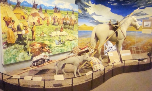
Armstead had been a community located near the historic confluence of the Beaverhead River and Horse Prairie Creek… both today are buried beneath the waters of the Clark Canyon Reservoir. To the Corps of Discovery, this was where the river they named the Jefferson River began. Merriweather Lewis called the area, “…one of the handsomest coves I ever saw.” It was the site of Camp Fortunate, where they stayed August 17-22, 1805. Sacagawea, kidnapped by Minnetaree Indians of the Dakota Nation five years previous, recognized her brother Cameahwait, Chief of the Shoshoni tribe. As an interpreter for Lewis and Clark, Sacagawea helped negotiate for horses and supplies.
It was here they cached the canoes and equipment they planned to retrieve on the return trip.
Named after Harvey Armstead, a miner, the village grew quickly. With two railroads in town, it soon became a major shipping point for livestock and ore coming from mines in the area. The Oregon Short Line was head-quartered in Armstead and shipped livestock of all kinds northward. The Gilmore and Pittsburg Railroad, which only operated from 1910–1939, moved west with passengers, livestock, and ore trailed in from the Horse Prairie, Grasshopper, and Big Hole valleys. Remnants of the railroad bed are visible as you drive the scenic route.
From 1961-1963, work commenced on the Clark Canyon Dam on the Beaverhead River. The residents of Armstead were bought out, and water covered the place in 1964.
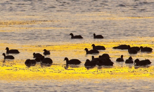
Clark Canyon Reservoir, sometimes called Clark Canyon Lake, is the terminus of the Red Rock River. Water stored during the winter season and spring runoff is released into Beaverhead River for downstream irrigation of crops and livestock ranching. The reservoir continues to be an ideal location for picnicking, fishing, boating, and camping. Often, visitors are favored with breathtaking sunsets.
Fishing is an important pursuit in Montana and the Red Rock River is a fine place to put in a line. From where it leaves Lima Dam until it arrives at the reservoir, one will find mountain whitefish, hybrid west slope cutthroat, rainbow, brown, and brook trout. Anglers have a good chance of experiencing long stretches of water to themselves, as this is a relatively remote area of Montana.
Red Rock River Valley’s high-country terrain offers almost unlimited opportunities for hiking, backpacking, mountain climbing, and cross country and backcountry skiing. And in some places, especially the Tendoys, motorized activities are permitted. Favorite accesses for outdoor activities are from Big Sheep and Little Sheep creek canyons. Numerous roads and trails lead into the Blacktail and Snowcrest ranges.


